You are here: Home > Network List > US - United States National Seismic Network Stations List
> Station ERPA Erie, Pennsylvania, USA > Earthquake Result Viewer
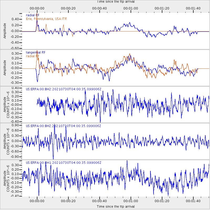
ERPA Erie, Pennsylvania, USA - Earthquake Result Viewer
*The percent match for this event was below the threshold and hence no stack was calculated.
| Earthquake location: |
South Of Alaska |
| Earthquake latitude/longitude: |
55.4/-157.0 |
| Earthquake time(UTC): |
2021/07/30 (211) 03:52:15 GMT |
| Earthquake Depth: |
33 km |
| Earthquake Magnitude: |
5.5 Mww |
| Earthquake Catalog/Contributor: |
NEIC PDE/ak |
|
| Network: |
US United States National Seismic Network |
| Station: |
ERPA Erie, Pennsylvania, USA |
| Lat/Lon: |
42.12 N/79.99 W |
| Elevation: |
306 m |
|
| Distance: |
49.9 deg |
| Az: |
71.389 deg |
| Baz: |
313.322 deg |
| Ray Param: |
$rayparam |
*The percent match for this event was below the threshold and hence was not used in the summary stack. |
|
| Radial Match: |
43.02506 % |
| Radial Bump: |
400 |
| Transverse Match: |
26.689472 % |
| Transverse Bump: |
400 |
| SOD ConfigId: |
25131211 |
| Insert Time: |
2021-08-13 04:10:13.931 +0000 |
| GWidth: |
2.5 |
| Max Bumps: |
400 |
| Tol: |
0.001 |
|
Signal To Noise
| Channel | StoN | STA | LTA |
| US:ERPA:00:BHZ:20210730T04:00:35.099006Z | 1.6598418 | 2.6570245E-7 | 1.6007698E-7 |
| US:ERPA:00:BH1:20210730T04:00:35.099006Z | 1.4104605 | 1.9638799E-7 | 1.3923679E-7 |
| US:ERPA:00:BH2:20210730T04:00:35.099006Z | 1.5853653 | 1.4679935E-7 | 9.2596544E-8 |
| Arrivals |
| Ps | |
| PpPs | |
| PsPs/PpSs | |


