You are here: Home > Network List > GS - US Geological Survey Networks Stations List
> Station KAN10 Keim Farm > Earthquake Result Viewer
KAN10 Keim Farm - Earthquake Result Viewer
*The percent match for this event was below the threshold and hence no stack was calculated.
| Earthquake location: |
Komandorskiye Ostrova Region |
| Earthquake latitude/longitude: |
55.4/166.5 |
| Earthquake time(UTC): |
2018/01/25 (025) 02:10:33 GMT |
| Earthquake Depth: |
8.8 km |
| Earthquake Magnitude: |
6.2 Mww |
| Earthquake Catalog/Contributor: |
NEIC PDE/us |
|
| Network: |
GS US Geological Survey Networks |
| Station: |
KAN10 Keim Farm |
| Lat/Lon: |
37.12 N/98.10 W |
| Elevation: |
417 m |
|
| Distance: |
63.2 deg |
| Az: |
63.032 deg |
| Baz: |
320.504 deg |
| Ray Param: |
$rayparam |
*The percent match for this event was below the threshold and hence was not used in the summary stack. |
|
| Radial Match: |
29.759787 % |
| Radial Bump: |
400 |
| Transverse Match: |
34.087597 % |
| Transverse Bump: |
400 |
| SOD ConfigId: |
2546091 |
| Insert Time: |
2018-02-08 02:12:38.864 +0000 |
| GWidth: |
2.5 |
| Max Bumps: |
400 |
| Tol: |
0.001 |
|
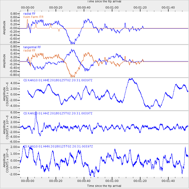
Signal To Noise
| Channel | StoN | STA | LTA |
| GS:KAN10:01:HHZ:20180125T02:20:31.00397Z | 4.2853703 | 9.580796E-7 | 2.2356984E-7 |
| GS:KAN10:01:HHN:20180125T02:20:31.00397Z | 4.192792 | 1.8339456E-6 | 4.3740437E-7 |
| GS:KAN10:01:HHE:20180125T02:20:31.00397Z | 1.0663826 | 1.6745491E-6 | 1.570308E-6 |
| Arrivals |
| Ps | |
| PpPs | |
| PsPs/PpSs | |


