You are here: Home > Network List > AV - Alaska Volcano Observatory Stations List
> Station KOFP Flat Point, Korovin Volcano, Alaska > Earthquake Result Viewer
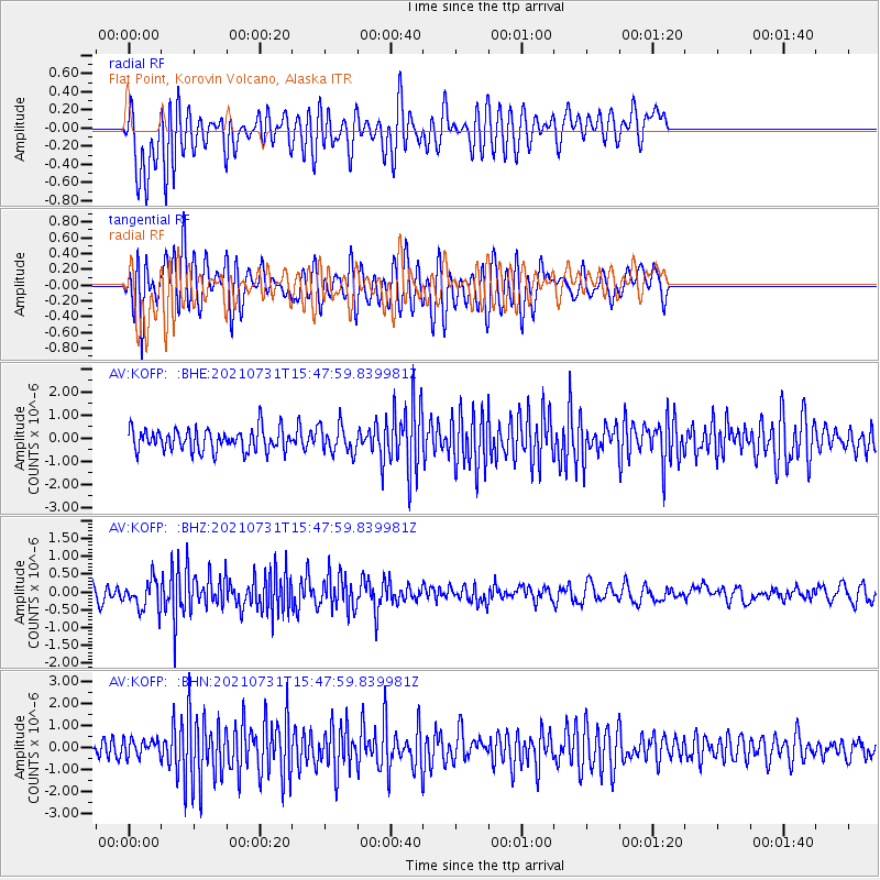
KOFP Flat Point, Korovin Volcano, Alaska - Earthquake Result Viewer
*The percent match for this event was below the threshold and hence no stack was calculated.
| Earthquake location: |
Gulf Of California |
| Earthquake latitude/longitude: |
27.6/-111.5 |
| Earthquake time(UTC): |
2021/07/31 (212) 15:39:20 GMT |
| Earthquake Depth: |
10 km |
| Earthquake Magnitude: |
5.5 mww |
| Earthquake Catalog/Contributor: |
NEIC PDE/us |
|
| Network: |
AV Alaska Volcano Observatory |
| Station: |
KOFP Flat Point, Korovin Volcano, Alaska |
| Lat/Lon: |
52.27 N/174.10 W |
| Elevation: |
662 m |
|
| Distance: |
52.1 deg |
| Az: |
316.242 deg |
| Baz: |
92.832 deg |
| Ray Param: |
$rayparam |
*The percent match for this event was below the threshold and hence was not used in the summary stack. |
|
| Radial Match: |
59.55364 % |
| Radial Bump: |
400 |
| Transverse Match: |
69.63875 % |
| Transverse Bump: |
400 |
| SOD ConfigId: |
25131211 |
| Insert Time: |
2021-08-14 15:41:57.473 +0000 |
| GWidth: |
2.5 |
| Max Bumps: |
400 |
| Tol: |
0.001 |
|
Signal To Noise
| Channel | StoN | STA | LTA |
| AV:KOFP: :BHZ:20210731T15:47:59.839981Z | 1.6552472 | 4.0547056E-7 | 2.4496072E-7 |
| AV:KOFP: :BHN:20210731T15:47:59.839981Z | 0.88731945 | 3.6908537E-7 | 4.1595544E-7 |
| AV:KOFP: :BHE:20210731T15:47:59.839981Z | 1.2704078 | 6.0117753E-7 | 4.732162E-7 |
| Arrivals |
| Ps | |
| PpPs | |
| PsPs/PpSs | |


