
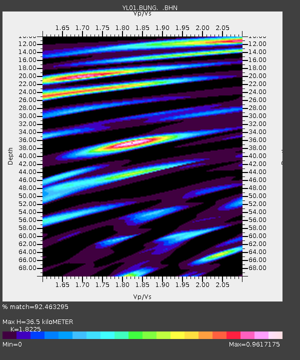
BUNG YL.BUNG - Earthquake Result Viewer
| ||||||||||||||||||
| ||||||||||||||||||
| ||||||||||||||||||
|
Signal To Noise
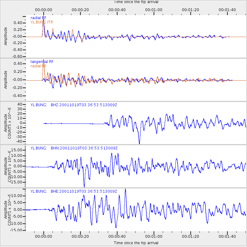
| Channel | StoN | STA | LTA |
| YL:BUNG: :BHN:20011019T03:36:53.513009Z | 3.7082403 | 2.2044797E-7 | 5.9448137E-8 |
| YL:BUNG: :BHE:20011019T03:36:53.513009Z | 3.3434649 | 4.561154E-7 | 1.3641998E-7 |
| YL:BUNG: :BHZ:20011019T03:36:53.513009Z | 4.8759723 | 9.032842E-7 | 1.8525212E-7 |
| Arrivals | |
| Ps | 5.2 SECOND |
| PpPs | 16 SECOND |
| PsPs/PpSs | 21 SECOND |

