BUNG YL.BUNG - Earthquake Result Viewer
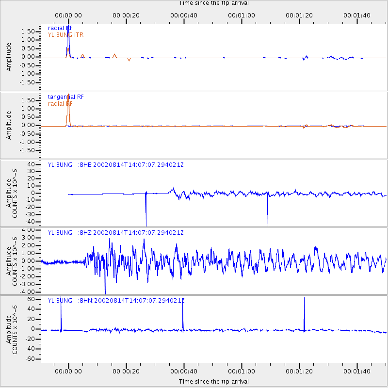
Earthquake location: Mariana Islands
Earthquake latitude/longitude: 14.1/146.2
Earthquake time(UTC): 2002/08/14 (226) 13:57:52 GMT
Earthquake Depth: 30 km
Earthquake Magnitude: 6.1 MB, 6.4 MS, 6.5 MW, 6.4 MW
Earthquake Catalog/Contributor: WHDF/NEIC
Network: YL Himalayan Nepal Tibet Experiment
Station: BUNG YL.BUNG
Lat/Lon: 27.88 N/85.89 E
Elevation: 1191 m
Distance: 57.4 deg
Az: 294.17 deg
Baz: 90.627 deg
Ray Param: 0.063434966
Estimated Moho Depth: 63.0 km
Estimated Crust Vp/Vs: 1.96
Assumed Crust Vp: 6.142 km/s
Estimated Crust Vs: 3.138 km/s
Estimated Crust Poisson's Ratio: 0.32
Radial Match: 97.34656 %
Radial Bump: 81
Transverse Match: 23.247555 %
Transverse Bump: 279
SOD ConfigId: 16820
Insert Time: 2010-02-26 15:51:21.815 +0000
GWidth: 2.5
Max Bumps: 400
Tol: 0.001

Signal To Noise

ChannelStoNSTALTA
YL:BUNG: :BHZ:20020814T14:07:07.294021Z0.49580978.484422E-81.7112254E-7
YL:BUNG: :BHN:20020814T14:07:07.294021Z1.80326137.3765074E-74.090648E-7
YL:BUNG: :BHE:20020814T14:07:07.294021Z1.97774777.602471E-73.8440044E-7
Arrivals
Ps10 SECOND
PpPs29 SECOND
PsPs/PpSs39 SECOND