You are here: Home > Network List > IU - Global Seismograph Network (GSN - IRIS/USGS) Stations List
> Station CTAO Charters Towers, Australia > Earthquake Result Viewer
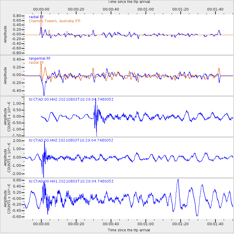
CTAO Charters Towers, Australia - Earthquake Result Viewer
*The percent match for this event was below the threshold and hence no stack was calculated.
| Earthquake location: |
South Of Fiji Islands |
| Earthquake latitude/longitude: |
-25.4/179.9 |
| Earthquake time(UTC): |
2021/08/03 (215) 10:23:52 GMT |
| Earthquake Depth: |
457 km |
| Earthquake Magnitude: |
5.5 Mww |
| Earthquake Catalog/Contributor: |
NEIC PDE/us |
|
| Network: |
IU Global Seismograph Network (GSN - IRIS/USGS) |
| Station: |
CTAO Charters Towers, Australia |
| Lat/Lon: |
20.09 S/146.25 E |
| Elevation: |
367 m |
|
| Distance: |
31.4 deg |
| Az: |
272.791 deg |
| Baz: |
106.075 deg |
| Ray Param: |
$rayparam |
*The percent match for this event was below the threshold and hence was not used in the summary stack. |
|
| Radial Match: |
49.08639 % |
| Radial Bump: |
400 |
| Transverse Match: |
61.807793 % |
| Transverse Bump: |
400 |
| SOD ConfigId: |
25131211 |
| Insert Time: |
2021-08-17 10:32:26.956 +0000 |
| GWidth: |
2.5 |
| Max Bumps: |
400 |
| Tol: |
0.001 |
|
Signal To Noise
| Channel | StoN | STA | LTA |
| IU:CTAO:00:HHZ:20210803T10:29:04.748005Z | 3.0822008 | 6.59534E-7 | 2.1398151E-7 |
| IU:CTAO:00:HH1:20210803T10:29:04.748005Z | 1.7216558 | 2.553756E-7 | 1.4833138E-7 |
| IU:CTAO:00:HH2:20210803T10:29:04.748005Z | 2.8758461 | 4.5714165E-7 | 1.5895901E-7 |
| Arrivals |
| Ps | |
| PpPs | |
| PsPs/PpSs | |


