You are here: Home > Network List > AZ - ANZA Regional Network Stations List
> Station SMER AZ.SMER > Earthquake Result Viewer
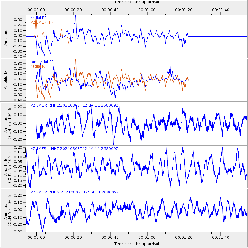
SMER AZ.SMER - Earthquake Result Viewer
*The percent match for this event was below the threshold and hence no stack was calculated.
| Earthquake location: |
Admiralty Islands Region, P.N.G. |
| Earthquake latitude/longitude: |
-1.5/148.1 |
| Earthquake time(UTC): |
2021/08/03 (215) 12:01:21 GMT |
| Earthquake Depth: |
10 km |
| Earthquake Magnitude: |
5.5 Mww |
| Earthquake Catalog/Contributor: |
NEIC PDE/us |
|
| Network: |
AZ ANZA Regional Network |
| Station: |
SMER AZ.SMER |
| Lat/Lon: |
33.46 N/117.17 W |
| Elevation: |
355 m |
|
| Distance: |
94.8 deg |
| Az: |
56.725 deg |
| Baz: |
271.336 deg |
| Ray Param: |
$rayparam |
*The percent match for this event was below the threshold and hence was not used in the summary stack. |
|
| Radial Match: |
49.80142 % |
| Radial Bump: |
400 |
| Transverse Match: |
41.6696 % |
| Transverse Bump: |
400 |
| SOD ConfigId: |
25131211 |
| Insert Time: |
2021-08-17 12:05:03.112 +0000 |
| GWidth: |
2.5 |
| Max Bumps: |
400 |
| Tol: |
0.001 |
|
Signal To Noise
| Channel | StoN | STA | LTA |
| AZ:SMER: :HHZ:20210803T12:14:11.268009Z | 0.87461126 | 9.123965E-8 | 1.0432023E-7 |
| AZ:SMER: :HHN:20210803T12:14:11.268009Z | 2.5507936 | 2.232522E-7 | 8.7522636E-8 |
| AZ:SMER: :HHE:20210803T12:14:11.268009Z | 1.299262 | 1.1516724E-7 | 8.8640505E-8 |
| Arrivals |
| Ps | |
| PpPs | |
| PsPs/PpSs | |


