BUNG YL.BUNG - Earthquake Result Viewer
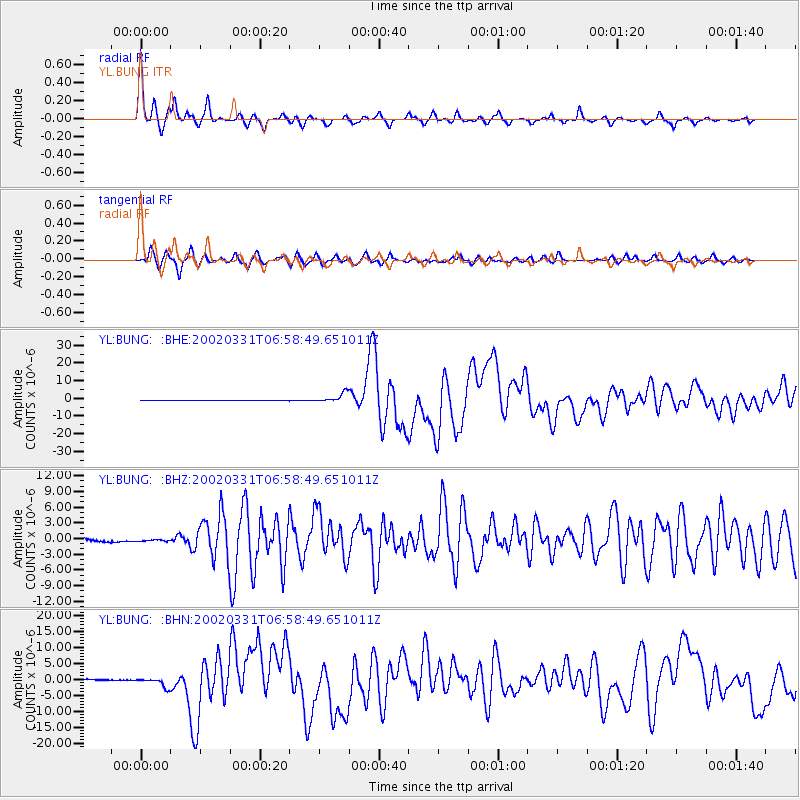
Earthquake location: Taiwan Region
Earthquake latitude/longitude: 24.3/122.2
Earthquake time(UTC): 2002/03/31 (090) 06:52:50 GMT
Earthquake Depth: 33 km
Earthquake Magnitude: 6.4 MB, 7.4 MS, 7.1 MW, 7.1 MW
Earthquake Catalog/Contributor: WHDF/NEIC
Network: YL Himalayan Nepal Tibet Experiment
Station: BUNG YL.BUNG
Lat/Lon: 27.88 N/85.89 E
Elevation: 1191 m
Distance: 32.7 deg
Az: 284.213 deg
Baz: 87.898 deg
Ray Param: 0.07848461
Estimated Moho Depth: 19.0 km
Estimated Crust Vp/Vs: 1.66
Assumed Crust Vp: 6.142 km/s
Estimated Crust Vs: 3.7 km/s
Estimated Crust Poisson's Ratio: 0.22
Radial Match: 90.55749 %
Radial Bump: 382
Transverse Match: 79.62916 %
Transverse Bump: 400
SOD ConfigId: 16820
Insert Time: 2010-02-26 15:51:32.447 +0000
GWidth: 2.5
Max Bumps: 400
Tol: 0.001

Signal To Noise

ChannelStoNSTALTA
YL:BUNG: :BHZ:20020331T06:58:49.651011Z1.61317744.113966E-72.5502254E-7
YL:BUNG: :BHN:20020331T06:58:49.651011Z16.1220761.5539425E-69.638601E-8
YL:BUNG: :BHE:20020331T06:58:49.651011Z23.5989882.722432E-61.1536224E-7
Arrivals
Ps2.2 SECOND
PpPs7.6 SECOND
PsPs/PpSs9.8 SECOND