You are here: Home > Network List > CI - Caltech Regional Seismic Network Stations List
> Station MPP McPhearson Peak > Earthquake Result Viewer
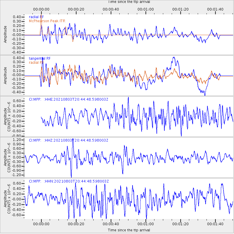
MPP McPhearson Peak - Earthquake Result Viewer
*The percent match for this event was below the threshold and hence no stack was calculated.
| Earthquake location: |
Off East Coast Of Honshu, Japan |
| Earthquake latitude/longitude: |
36.1/142.1 |
| Earthquake time(UTC): |
2021/08/03 (215) 20:33:32 GMT |
| Earthquake Depth: |
10 km |
| Earthquake Magnitude: |
5.8 mww |
| Earthquake Catalog/Contributor: |
NEIC PDE/us |
|
| Network: |
CI Caltech Regional Seismic Network |
| Station: |
MPP McPhearson Peak |
| Lat/Lon: |
34.89 N/119.81 W |
| Elevation: |
1739 m |
|
| Distance: |
76.1 deg |
| Az: |
56.987 deg |
| Baz: |
304.298 deg |
| Ray Param: |
$rayparam |
*The percent match for this event was below the threshold and hence was not used in the summary stack. |
|
| Radial Match: |
53.669426 % |
| Radial Bump: |
400 |
| Transverse Match: |
45.594505 % |
| Transverse Bump: |
400 |
| SOD ConfigId: |
25131211 |
| Insert Time: |
2021-08-17 20:51:18.566 +0000 |
| GWidth: |
2.5 |
| Max Bumps: |
400 |
| Tol: |
0.001 |
|
Signal To Noise
| Channel | StoN | STA | LTA |
| CI:MPP: :HHZ:20210803T20:44:48.598003Z | 0.95783615 | 1.3028514E-7 | 1.3602028E-7 |
| CI:MPP: :HHN:20210803T20:44:48.598003Z | 0.9225342 | 1.8766956E-7 | 2.0342829E-7 |
| CI:MPP: :HHE:20210803T20:44:48.598003Z | 1.2428836 | 2.4221742E-7 | 1.9488343E-7 |
| Arrivals |
| Ps | |
| PpPs | |
| PsPs/PpSs | |


