BUNG YL.BUNG - Earthquake Result Viewer
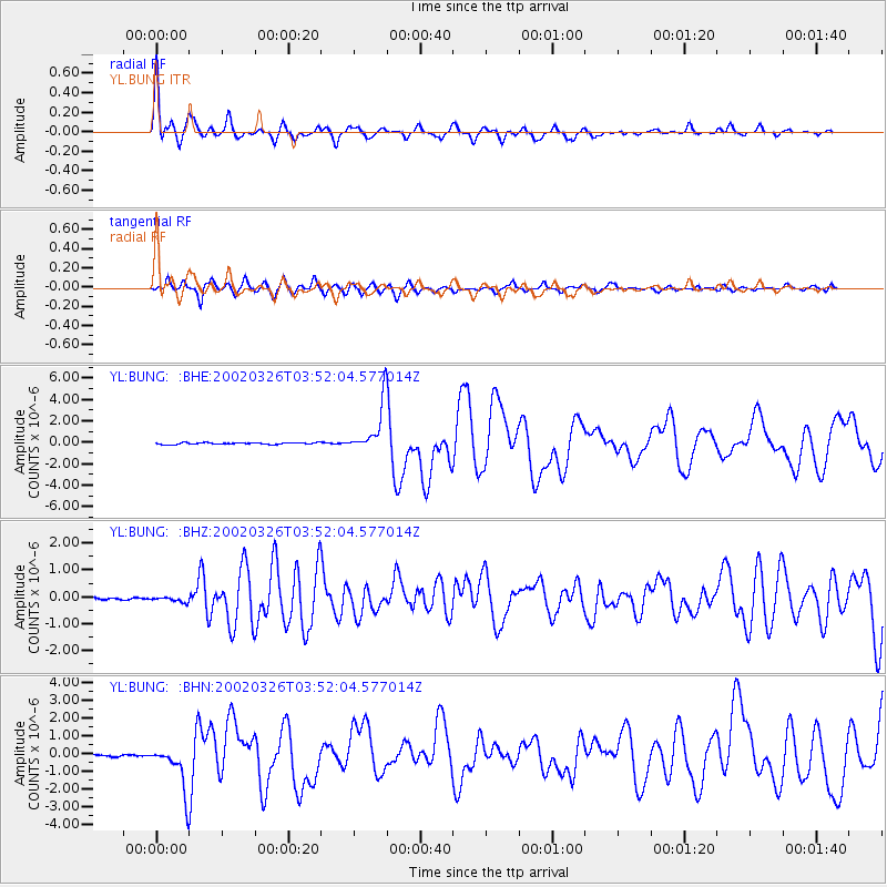
Earthquake location: Southwestern Ryukyu Isl., Japan
Earthquake latitude/longitude: 23.3/124.1
Earthquake time(UTC): 2002/03/26 (085) 03:45:48 GMT
Earthquake Depth: 33 km
Earthquake Magnitude: 5.8 MB, 6.6 MS, 6.4 MW, 6.4 MW
Earthquake Catalog/Contributor: WHDF/NEIC
Network: YL Himalayan Nepal Tibet Experiment
Station: BUNG YL.BUNG
Lat/Lon: 27.88 N/85.89 E
Elevation: 1191 m
Distance: 34.6 deg
Az: 285.65 deg
Baz: 88.703 deg
Ray Param: 0.0775748
Estimated Moho Depth: 35.0 km
Estimated Crust Vp/Vs: 1.92
Assumed Crust Vp: 6.142 km/s
Estimated Crust Vs: 3.195 km/s
Estimated Crust Poisson's Ratio: 0.31
Radial Match: 85.5862 %
Radial Bump: 400
Transverse Match: 71.26225 %
Transverse Bump: 400
SOD ConfigId: 16820
Insert Time: 2010-02-26 15:51:35.282 +0000
GWidth: 2.5
Max Bumps: 400
Tol: 0.001

Signal To Noise

ChannelStoNSTALTA
YL:BUNG: :BHZ:20020326T03:52:04.577014Z2.72538331.0118283E-73.7126092E-8
YL:BUNG: :BHN:20020326T03:52:04.577014Z8.4902041.3142516E-61.5479623E-7
YL:BUNG: :BHE:20020326T03:52:04.577014Z27.133572.265862E-68.350769E-8
Arrivals
Ps5.6 SECOND
PpPs16 SECOND
PsPs/PpSs21 SECOND