You are here: Home > Network List > US - United States National Seismic Network Stations List
> Station MIAR Mount Ida, Arkansas, USA > Earthquake Result Viewer
MIAR Mount Ida, Arkansas, USA - Earthquake Result Viewer
*The percent match for this event was below the threshold and hence no stack was calculated.
| Earthquake location: |
Near East Coast Of Honshu, Japan |
| Earthquake latitude/longitude: |
36.1/142.0 |
| Earthquake time(UTC): |
2021/08/04 (216) 04:40:23 GMT |
| Earthquake Depth: |
14 km |
| Earthquake Magnitude: |
5.7 mww |
| Earthquake Catalog/Contributor: |
NEIC PDE/us |
|
| Network: |
US United States National Seismic Network |
| Station: |
MIAR Mount Ida, Arkansas, USA |
| Lat/Lon: |
34.55 N/93.58 W |
| Elevation: |
207 m |
|
| Distance: |
92.7 deg |
| Az: |
42.95 deg |
| Baz: |
318.074 deg |
| Ray Param: |
$rayparam |
*The percent match for this event was below the threshold and hence was not used in the summary stack. |
|
| Radial Match: |
54.52389 % |
| Radial Bump: |
363 |
| Transverse Match: |
59.492393 % |
| Transverse Bump: |
400 |
| SOD ConfigId: |
25131211 |
| Insert Time: |
2021-08-18 05:07:52.738 +0000 |
| GWidth: |
2.5 |
| Max Bumps: |
400 |
| Tol: |
0.001 |
|
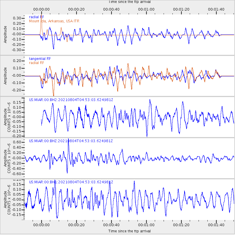
Signal To Noise
| Channel | StoN | STA | LTA |
| US:MIAR:00:BHZ:20210804T04:53:03.624981Z | 1.7264458 | 1.3442575E-7 | 7.786271E-8 |
| US:MIAR:00:BH1:20210804T04:53:03.624981Z | 1.1619664 | 7.7157445E-8 | 6.640247E-8 |
| US:MIAR:00:BH2:20210804T04:53:03.624981Z | 0.77281326 | 5.422638E-8 | 7.016751E-8 |
| Arrivals |
| Ps | |
| PpPs | |
| PsPs/PpSs | |


