You are here: Home > Network List > CI - Caltech Regional Seismic Network Stations List
> Station MPM Manuel Prospect Mine, California, USA > Earthquake Result Viewer
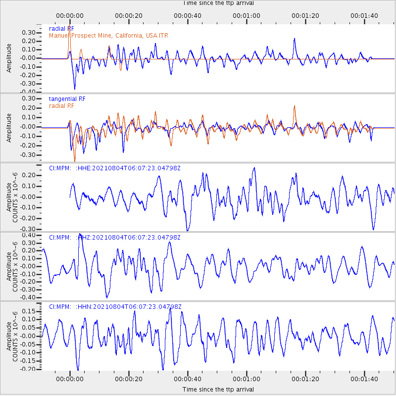
MPM Manuel Prospect Mine, California, USA - Earthquake Result Viewer
*The percent match for this event was below the threshold and hence no stack was calculated.
| Earthquake location: |
Vanuatu Islands Region |
| Earthquake latitude/longitude: |
-20.5/172.6 |
| Earthquake time(UTC): |
2021/08/04 (216) 05:55:12 GMT |
| Earthquake Depth: |
23 km |
| Earthquake Magnitude: |
5.5 Mww |
| Earthquake Catalog/Contributor: |
NEIC PDE/us |
|
| Network: |
CI Caltech Regional Seismic Network |
| Station: |
MPM Manuel Prospect Mine, California, USA |
| Lat/Lon: |
36.06 N/117.49 W |
| Elevation: |
185 m |
|
| Distance: |
86.7 deg |
| Az: |
49.658 deg |
| Baz: |
241.869 deg |
| Ray Param: |
$rayparam |
*The percent match for this event was below the threshold and hence was not used in the summary stack. |
|
| Radial Match: |
61.326366 % |
| Radial Bump: |
400 |
| Transverse Match: |
72.59539 % |
| Transverse Bump: |
400 |
| SOD ConfigId: |
25131211 |
| Insert Time: |
2021-08-18 06:04:15.557 +0000 |
| GWidth: |
2.5 |
| Max Bumps: |
400 |
| Tol: |
0.001 |
|
Signal To Noise
| Channel | StoN | STA | LTA |
| CI:MPM: :HHZ:20210804T06:07:23.04798Z | 2.1078298 | 2.057366E-7 | 9.7605884E-8 |
| CI:MPM: :HHN:20210804T06:07:23.04798Z | 1.4886136 | 8.760938E-8 | 5.8853E-8 |
| CI:MPM: :HHE:20210804T06:07:23.04798Z | 2.2176685 | 1.2414426E-7 | 5.597963E-8 |
| Arrivals |
| Ps | |
| PpPs | |
| PsPs/PpSs | |


