You are here: Home > Network List > US - United States National Seismic Network Stations List
> Station HAWA Hanford, Washington, USA > Earthquake Result Viewer
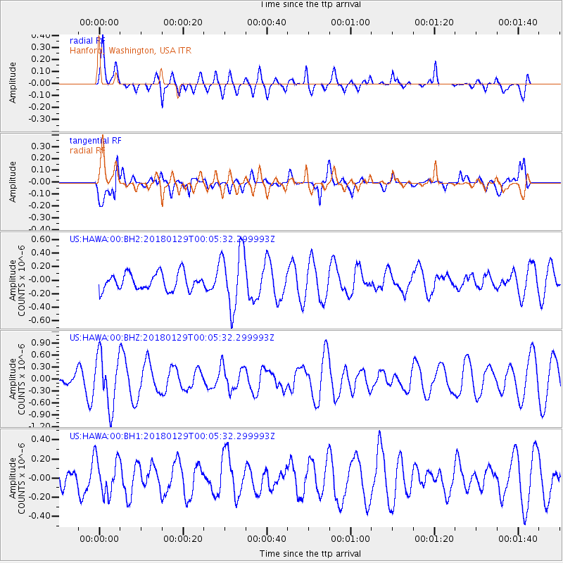
HAWA Hanford, Washington, USA - Earthquake Result Viewer
*The percent match for this event was below the threshold and hence no stack was calculated.
| Earthquake location: |
San Juan Province, Argentina |
| Earthquake latitude/longitude: |
-31.3/-68.7 |
| Earthquake time(UTC): |
2018/01/28 (028) 23:53:14 GMT |
| Earthquake Depth: |
88 km |
| Earthquake Magnitude: |
5.4 Mww |
| Earthquake Catalog/Contributor: |
NEIC PDE/us |
|
| Network: |
US United States National Seismic Network |
| Station: |
HAWA Hanford, Washington, USA |
| Lat/Lon: |
46.39 N/119.53 W |
| Elevation: |
364 m |
|
| Distance: |
89.9 deg |
| Az: |
327.531 deg |
| Baz: |
138.384 deg |
| Ray Param: |
$rayparam |
*The percent match for this event was below the threshold and hence was not used in the summary stack. |
|
| Radial Match: |
76.914955 % |
| Radial Bump: |
400 |
| Transverse Match: |
70.625565 % |
| Transverse Bump: |
400 |
| SOD ConfigId: |
2546091 |
| Insert Time: |
2018-02-11 23:57:30.417 +0000 |
| GWidth: |
2.5 |
| Max Bumps: |
400 |
| Tol: |
0.001 |
|
Signal To Noise
| Channel | StoN | STA | LTA |
| US:HAWA:00:BHZ:20180129T00:05:32.299993Z | 1.8273745 | 6.6952725E-7 | 3.6638755E-7 |
| US:HAWA:00:BH1:20180129T00:05:32.299993Z | 1.3417526 | 1.8683345E-7 | 1.3924581E-7 |
| US:HAWA:00:BH2:20180129T00:05:32.299993Z | 3.5772362 | 4.4042665E-7 | 1.2311925E-7 |
| Arrivals |
| Ps | |
| PpPs | |
| PsPs/PpSs | |


