You are here: Home > Network List > AV - Alaska Volcano Observatory Stations List
> Station SPCR Ckakachatna River, Mount Spurr, Alaska > Earthquake Result Viewer
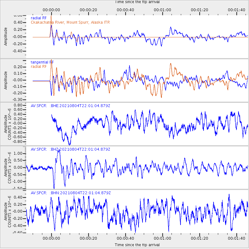
SPCR Ckakachatna River, Mount Spurr, Alaska - Earthquake Result Viewer
*The percent match for this event was below the threshold and hence no stack was calculated.
| Earthquake location: |
Taiwan Region |
| Earthquake latitude/longitude: |
24.8/122.3 |
| Earthquake time(UTC): |
2021/08/04 (216) 21:50:46 GMT |
| Earthquake Depth: |
11 km |
| Earthquake Magnitude: |
5.8 mww |
| Earthquake Catalog/Contributor: |
NEIC PDE/us |
|
| Network: |
AV Alaska Volcano Observatory |
| Station: |
SPCR Ckakachatna River, Mount Spurr, Alaska |
| Lat/Lon: |
61.20 N/152.21 W |
| Elevation: |
984 m |
|
| Distance: |
66.5 deg |
| Az: |
31.773 deg |
| Baz: |
278.766 deg |
| Ray Param: |
$rayparam |
*The percent match for this event was below the threshold and hence was not used in the summary stack. |
|
| Radial Match: |
44.61367 % |
| Radial Bump: |
400 |
| Transverse Match: |
39.685734 % |
| Transverse Bump: |
400 |
| SOD ConfigId: |
25131211 |
| Insert Time: |
2021-08-18 21:57:46.510 +0000 |
| GWidth: |
2.5 |
| Max Bumps: |
400 |
| Tol: |
0.001 |
|
Signal To Noise
| Channel | StoN | STA | LTA |
| AV:SPCR: :BHZ:20210804T22:01:04.879Z | 7.4798017 | 7.922485E-7 | 1.0591838E-7 |
| AV:SPCR: :BHN:20210804T22:01:04.879Z | 1.6023841 | 2.7033406E-7 | 1.687074E-7 |
| AV:SPCR: :BHE:20210804T22:01:04.879Z | 1.2887269 | 4.1869333E-7 | 3.248891E-7 |
| Arrivals |
| Ps | |
| PpPs | |
| PsPs/PpSs | |


