You are here: Home > Network List > US - United States National Seismic Network Stations List
> Station HAWA Hanford, Washington, USA > Earthquake Result Viewer
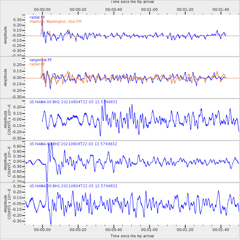
HAWA Hanford, Washington, USA - Earthquake Result Viewer
*The percent match for this event was below the threshold and hence no stack was calculated.
| Earthquake location: |
Taiwan Region |
| Earthquake latitude/longitude: |
24.8/122.3 |
| Earthquake time(UTC): |
2021/08/04 (216) 21:50:46 GMT |
| Earthquake Depth: |
11 km |
| Earthquake Magnitude: |
5.8 mww |
| Earthquake Catalog/Contributor: |
NEIC PDE/us |
|
| Network: |
US United States National Seismic Network |
| Station: |
HAWA Hanford, Washington, USA |
| Lat/Lon: |
46.39 N/119.53 W |
| Elevation: |
364 m |
|
| Distance: |
89.8 deg |
| Az: |
37.594 deg |
| Baz: |
306.765 deg |
| Ray Param: |
$rayparam |
*The percent match for this event was below the threshold and hence was not used in the summary stack. |
|
| Radial Match: |
70.766 % |
| Radial Bump: |
400 |
| Transverse Match: |
73.05317 % |
| Transverse Bump: |
400 |
| SOD ConfigId: |
25131211 |
| Insert Time: |
2021-08-18 22:09:57.989 +0000 |
| GWidth: |
2.5 |
| Max Bumps: |
400 |
| Tol: |
0.001 |
|
Signal To Noise
| Channel | StoN | STA | LTA |
| US:HAWA:00:BHZ:20210804T22:03:13.574983Z | 8.154541 | 5.379738E-7 | 6.59723E-8 |
| US:HAWA:00:BH1:20210804T22:03:13.574983Z | 3.334501 | 1.5957961E-7 | 4.7857124E-8 |
| US:HAWA:00:BH2:20210804T22:03:13.574983Z | 1.8725765 | 1.2536708E-7 | 6.694897E-8 |
| Arrivals |
| Ps | |
| PpPs | |
| PsPs/PpSs | |


