You are here: Home > Network List > US - United States National Seismic Network Stations List
> Station MSO Missoula, Montana, USA > Earthquake Result Viewer
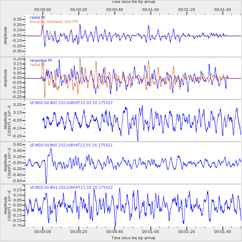
MSO Missoula, Montana, USA - Earthquake Result Viewer
*The percent match for this event was below the threshold and hence no stack was calculated.
| Earthquake location: |
Taiwan Region |
| Earthquake latitude/longitude: |
24.8/122.3 |
| Earthquake time(UTC): |
2021/08/04 (216) 21:50:46 GMT |
| Earthquake Depth: |
11 km |
| Earthquake Magnitude: |
5.8 mww |
| Earthquake Catalog/Contributor: |
NEIC PDE/us |
|
| Network: |
US United States National Seismic Network |
| Station: |
MSO Missoula, Montana, USA |
| Lat/Lon: |
46.83 N/113.94 W |
| Elevation: |
1264 m |
|
| Distance: |
92.5 deg |
| Az: |
34.837 deg |
| Baz: |
310.872 deg |
| Ray Param: |
$rayparam |
*The percent match for this event was below the threshold and hence was not used in the summary stack. |
|
| Radial Match: |
55.519157 % |
| Radial Bump: |
400 |
| Transverse Match: |
61.128944 % |
| Transverse Bump: |
400 |
| SOD ConfigId: |
25131211 |
| Insert Time: |
2021-08-18 22:10:03.824 +0000 |
| GWidth: |
2.5 |
| Max Bumps: |
400 |
| Tol: |
0.001 |
|
Signal To Noise
| Channel | StoN | STA | LTA |
| US:MSO:00:BHZ:20210804T22:03:26.17502Z | 4.977912 | 3.031988E-7 | 6.090883E-8 |
| US:MSO:00:BH1:20210804T22:03:26.17502Z | 2.0491824 | 8.351458E-8 | 4.0755072E-8 |
| US:MSO:00:BH2:20210804T22:03:26.17502Z | 1.0974381 | 6.4970884E-8 | 5.920232E-8 |
| Arrivals |
| Ps | |
| PpPs | |
| PsPs/PpSs | |


