You are here: Home > Network List > WY - Yellowstone Wyoming Seismic Network Stations List
> Station YHH Holmes Hill, YNP, WY, USA > Earthquake Result Viewer
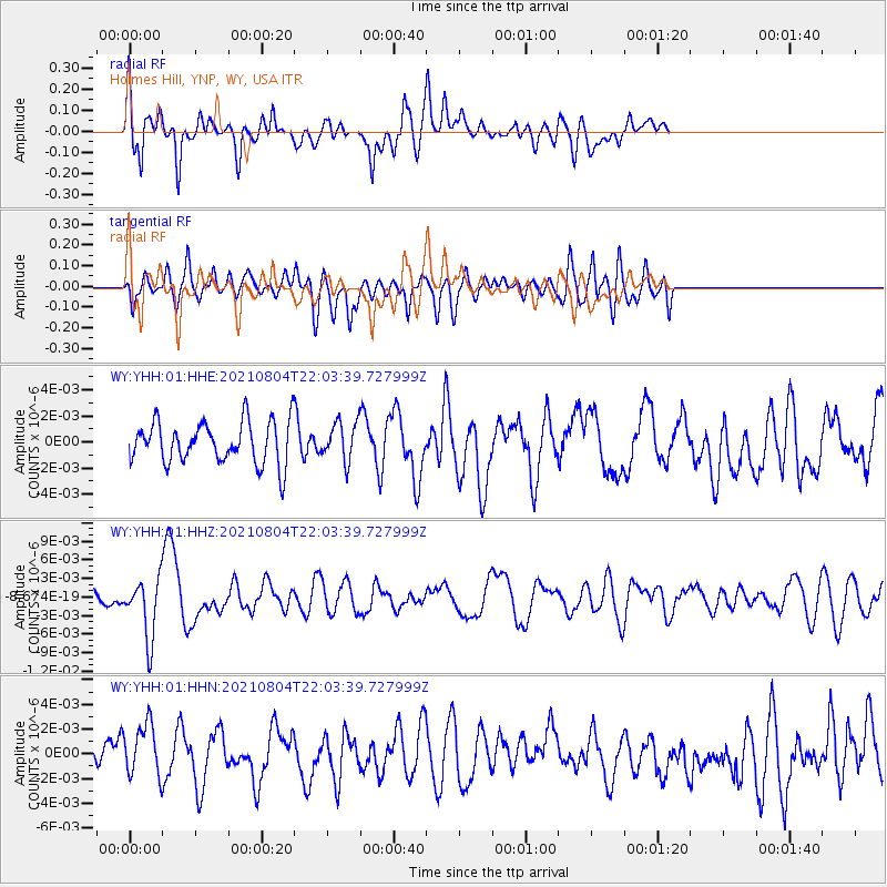
YHH Holmes Hill, YNP, WY, USA - Earthquake Result Viewer
*The percent match for this event was below the threshold and hence no stack was calculated.
| Earthquake location: |
Taiwan Region |
| Earthquake latitude/longitude: |
24.8/122.3 |
| Earthquake time(UTC): |
2021/08/04 (216) 21:50:46 GMT |
| Earthquake Depth: |
11 km |
| Earthquake Magnitude: |
5.8 mww |
| Earthquake Catalog/Contributor: |
NEIC PDE/us |
|
| Network: |
WY Yellowstone Wyoming Seismic Network |
| Station: |
YHH Holmes Hill, YNP, WY, USA |
| Lat/Lon: |
44.79 N/110.85 W |
| Elevation: |
2717 m |
|
| Distance: |
95.5 deg |
| Az: |
34.909 deg |
| Baz: |
313.076 deg |
| Ray Param: |
$rayparam |
*The percent match for this event was below the threshold and hence was not used in the summary stack. |
|
| Radial Match: |
60.12961 % |
| Radial Bump: |
400 |
| Transverse Match: |
49.312798 % |
| Transverse Bump: |
400 |
| SOD ConfigId: |
25131211 |
| Insert Time: |
2021-08-18 22:12:36.358 +0000 |
| GWidth: |
2.5 |
| Max Bumps: |
400 |
| Tol: |
0.001 |
|
Signal To Noise
| Channel | StoN | STA | LTA |
| WY:YHH:01:HHZ:20210804T22:03:39.727999Z | 2.665504 | 4.805319E-9 | 1.8027805E-9 |
| WY:YHH:01:HHN:20210804T22:03:39.727999Z | 1.2796396 | 2.3676023E-9 | 1.8502102E-9 |
| WY:YHH:01:HHE:20210804T22:03:39.727999Z | 0.92423135 | 1.4727422E-9 | 1.5934779E-9 |
| Arrivals |
| Ps | |
| PpPs | |
| PsPs/PpSs | |


