You are here: Home > Network List > CI - Caltech Regional Seismic Network Stations List
> Station MPP McPhearson Peak > Earthquake Result Viewer
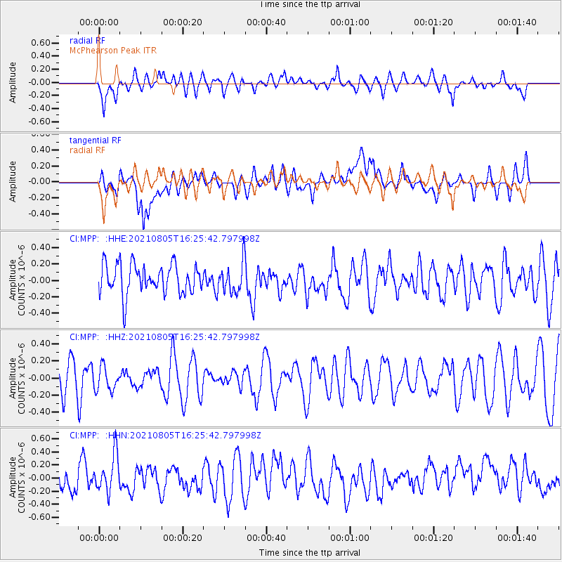
MPP McPhearson Peak - Earthquake Result Viewer
*The percent match for this event was below the threshold and hence no stack was calculated.
| Earthquake location: |
Hawaii |
| Earthquake latitude/longitude: |
19.4/-155.3 |
| Earthquake time(UTC): |
2021/08/05 (217) 16:19:20 GMT |
| Earthquake Depth: |
4.2 km |
| Earthquake Magnitude: |
0.8 Md |
| Earthquake Catalog/Contributor: |
NEIC PDE/hv |
|
| Network: |
CI Caltech Regional Seismic Network |
| Station: |
MPP McPhearson Peak |
| Lat/Lon: |
34.89 N/119.81 W |
| Elevation: |
1739 m |
|
| Distance: |
34.9 deg |
| Az: |
56.507 deg |
| Baz: |
253.203 deg |
| Ray Param: |
$rayparam |
*The percent match for this event was below the threshold and hence was not used in the summary stack. |
|
| Radial Match: |
48.90966 % |
| Radial Bump: |
400 |
| Transverse Match: |
40.73652 % |
| Transverse Bump: |
400 |
| SOD ConfigId: |
25131211 |
| Insert Time: |
2021-08-19 16:25:40.119 +0000 |
| GWidth: |
2.5 |
| Max Bumps: |
400 |
| Tol: |
0.001 |
|
Signal To Noise
| Channel | StoN | STA | LTA |
| CI:MPP: :HHZ:20210805T16:25:42.797998Z | 1.024244 | 1.4095973E-7 | 1.376232E-7 |
| CI:MPP: :HHN:20210805T16:25:42.797998Z | 1.9007349 | 3.3582268E-7 | 1.7668043E-7 |
| CI:MPP: :HHE:20210805T16:25:42.797998Z | 1.0570141 | 1.8944961E-7 | 1.7923091E-7 |
| Arrivals |
| Ps | |
| PpPs | |
| PsPs/PpSs | |


