You are here: Home > Network List > US - United States National Seismic Network Stations List
> Station LKWY Lake (Yellowstone--Lake), Wyoming, USA > Earthquake Result Viewer
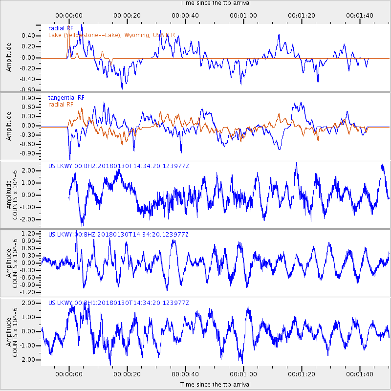
LKWY Lake (Yellowstone--Lake), Wyoming, USA - Earthquake Result Viewer
*The percent match for this event was below the threshold and hence no stack was calculated.
| Earthquake location: |
Near Coast Of Peru |
| Earthquake latitude/longitude: |
-15.9/-74.6 |
| Earthquake time(UTC): |
2018/01/30 (030) 14:23:49 GMT |
| Earthquake Depth: |
10 km |
| Earthquake Magnitude: |
5.3 Mww |
| Earthquake Catalog/Contributor: |
NEIC PDE/us |
|
| Network: |
US United States National Seismic Network |
| Station: |
LKWY Lake (Yellowstone--Lake), Wyoming, USA |
| Lat/Lon: |
44.57 N/110.40 W |
| Elevation: |
2424 m |
|
| Distance: |
68.4 deg |
| Az: |
333.28 deg |
| Baz: |
142.741 deg |
| Ray Param: |
$rayparam |
*The percent match for this event was below the threshold and hence was not used in the summary stack. |
|
| Radial Match: |
49.467953 % |
| Radial Bump: |
400 |
| Transverse Match: |
59.926952 % |
| Transverse Bump: |
400 |
| SOD ConfigId: |
2546091 |
| Insert Time: |
2018-02-13 14:28:00.071 +0000 |
| GWidth: |
2.5 |
| Max Bumps: |
400 |
| Tol: |
0.001 |
|
Signal To Noise
| Channel | StoN | STA | LTA |
| US:LKWY:00:BHZ:20180130T14:34:20.123977Z | 1.0081435 | 3.811809E-7 | 3.781018E-7 |
| US:LKWY:00:BH1:20180130T14:34:20.123977Z | 1.812556 | 1.1670668E-6 | 6.43879E-7 |
| US:LKWY:00:BH2:20180130T14:34:20.123977Z | 0.99698347 | 1.0041149E-6 | 1.0071531E-6 |
| Arrivals |
| Ps | |
| PpPs | |
| PsPs/PpSs | |


