BUNG YL.BUNG - Earthquake Result Viewer
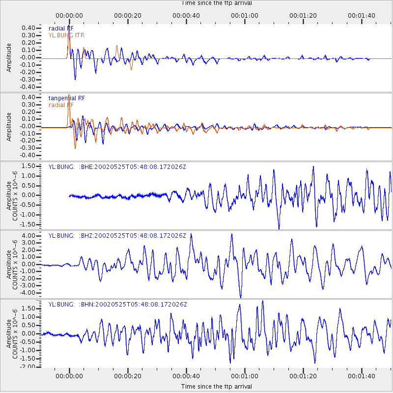
Earthquake location: South Of Alaska
Earthquake latitude/longitude: 53.8/-161.1
Earthquake time(UTC): 2002/05/25 (145) 05:36:31 GMT
Earthquake Depth: 33 km
Earthquake Magnitude: 5.5 MB, 6.1 MS, 6.5 MW, 6.4 MW
Earthquake Catalog/Contributor: WHDF/NEIC
Network: YL Himalayan Nepal Tibet Experiment
Station: BUNG YL.BUNG
Lat/Lon: 27.88 N/85.89 E
Elevation: 1191 m
Distance: 80.2 deg
Az: 304.221 deg
Baz: 33.634 deg
Ray Param: 0.048365343
Estimated Moho Depth: 32.0 km
Estimated Crust Vp/Vs: 1.60
Assumed Crust Vp: 6.142 km/s
Estimated Crust Vs: 3.839 km/s
Estimated Crust Poisson's Ratio: 0.18
Radial Match: 91.662384 %
Radial Bump: 400
Transverse Match: 86.30398 %
Transverse Bump: 400
SOD ConfigId: 16844
Insert Time: 2010-02-26 15:52:10.085 +0000
GWidth: 2.5
Max Bumps: 400
Tol: 0.001

Signal To Noise

ChannelStoNSTALTA
YL:BUNG: :BHZ:20020525T05:48:08.172026Z6.8750024.267248E-76.206905E-8
YL:BUNG: :BHN:20020525T05:48:08.172026Z3.15322471.8374371E-75.8271684E-8
YL:BUNG: :BHE:20020525T05:48:08.172026Z2.0024161.0735179E-75.3611135E-8
Arrivals
Ps3.2 SECOND
PpPs13 SECOND
PsPs/PpSs16 SECOND