BUNG YL.BUNG - Earthquake Result Viewer
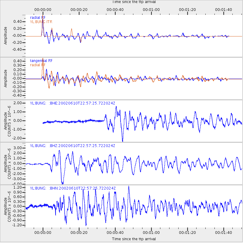
Earthquake location: W. Caroline Islands, Micronesia
Earthquake latitude/longitude: 11.0/140.7
Earthquake time(UTC): 2002/06/10 (161) 22:48:36 GMT
Earthquake Depth: 33 km
Earthquake Magnitude: 5.9 MB, 5.9 MS, 6.1 MW, 6.0 MW
Earthquake Catalog/Contributor: WHDF/NEIC
Network: YL Himalayan Nepal Tibet Experiment
Station: BUNG YL.BUNG
Lat/Lon: 27.88 N/85.89 E
Elevation: 1191 m
Distance: 53.9 deg
Az: 296.465 deg
Baz: 96.8 deg
Ray Param: 0.06572445
Estimated Moho Depth: 10.25 km
Estimated Crust Vp/Vs: 2.10
Assumed Crust Vp: 6.142 km/s
Estimated Crust Vs: 2.928 km/s
Estimated Crust Poisson's Ratio: 0.35
Radial Match: 86.07847 %
Radial Bump: 400
Transverse Match: 74.57481 %
Transverse Bump: 400
SOD ConfigId: 16844
Insert Time: 2010-02-26 15:52:16.521 +0000
GWidth: 2.5
Max Bumps: 400
Tol: 0.001

Signal To Noise

ChannelStoNSTALTA
YL:BUNG: :BHZ:20020610T22:57:25.722024Z6.7163424.1457497E-76.1726304E-8
YL:BUNG: :BHN:20020610T22:57:25.722024Z1.75263121.226047E-76.9954645E-8
YL:BUNG: :BHE:20020610T22:57:25.722024Z3.6796632.2415276E-76.0916655E-8
Arrivals
Ps1.9 SECOND
PpPs5.0 SECOND
PsPs/PpSs6.9 SECOND