You are here: Home > Network List > CI - Caltech Regional Seismic Network Stations List
> Station SWS Sam W. Stewart, Westmorland, CA, USA > Earthquake Result Viewer
SWS Sam W. Stewart, Westmorland, CA, USA - Earthquake Result Viewer
*The percent match for this event was below the threshold and hence no stack was calculated.
| Earthquake location: |
Solomon Islands |
| Earthquake latitude/longitude: |
-10.1/161.1 |
| Earthquake time(UTC): |
2021/08/07 (219) 14:51:31 GMT |
| Earthquake Depth: |
61 km |
| Earthquake Magnitude: |
5.3 Mww |
| Earthquake Catalog/Contributor: |
NEIC PDE/us |
|
| Network: |
CI Caltech Regional Seismic Network |
| Station: |
SWS Sam W. Stewart, Westmorland, CA, USA |
| Lat/Lon: |
32.94 N/115.80 W |
| Elevation: |
140 m |
|
| Distance: |
89.7 deg |
| Az: |
56.598 deg |
| Baz: |
257.878 deg |
| Ray Param: |
$rayparam |
*The percent match for this event was below the threshold and hence was not used in the summary stack. |
|
| Radial Match: |
61.227238 % |
| Radial Bump: |
395 |
| Transverse Match: |
65.17211 % |
| Transverse Bump: |
400 |
| SOD ConfigId: |
25131211 |
| Insert Time: |
2021-08-21 15:00:48.764 +0000 |
| GWidth: |
2.5 |
| Max Bumps: |
400 |
| Tol: |
0.001 |
|
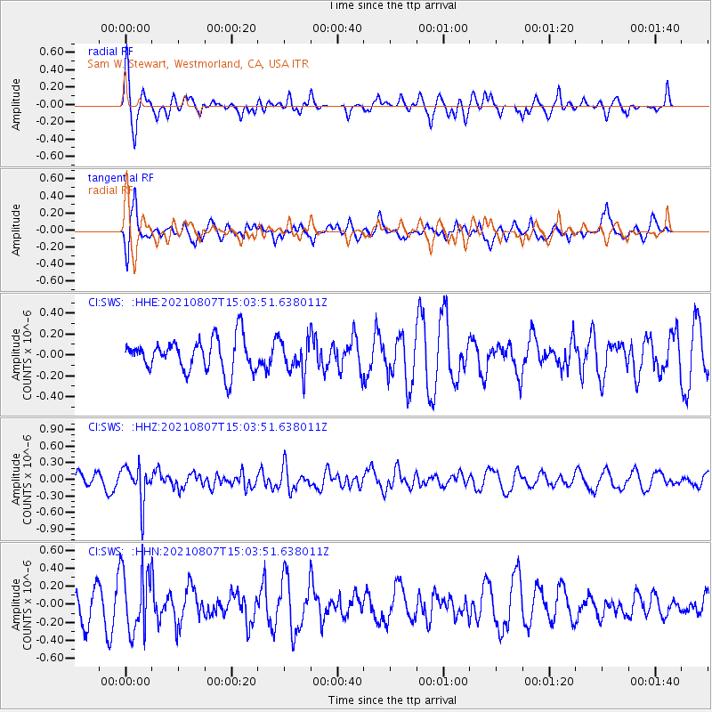
Signal To Noise
| Channel | StoN | STA | LTA |
| CI:SWS: :HHZ:20210807T15:03:51.638011Z | 3.0460787 | 3.3856338E-7 | 1.1114729E-7 |
| CI:SWS: :HHN:20210807T15:03:51.638011Z | 1.4678059 | 3.496054E-7 | 2.381823E-7 |
| CI:SWS: :HHE:20210807T15:03:51.638011Z | 0.9713691 | 1.5182907E-7 | 1.563042E-7 |
| Arrivals |
| Ps | |
| PpPs | |
| PsPs/PpSs | |


