You are here: Home > Network List > CN - Canadian National Seismograph Network Stations List
> Station INK INUVIK, NT > Earthquake Result Viewer
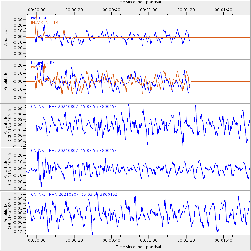
INK INUVIK, NT - Earthquake Result Viewer
*The percent match for this event was below the threshold and hence no stack was calculated.
| Earthquake location: |
Solomon Islands |
| Earthquake latitude/longitude: |
-10.1/161.1 |
| Earthquake time(UTC): |
2021/08/07 (219) 14:51:31 GMT |
| Earthquake Depth: |
61 km |
| Earthquake Magnitude: |
5.3 Mww |
| Earthquake Catalog/Contributor: |
NEIC PDE/us |
|
| Network: |
CN Canadian National Seismograph Network |
| Station: |
INK INUVIK, NT |
| Lat/Lon: |
68.31 N/133.53 W |
| Elevation: |
44 m |
|
| Distance: |
90.5 deg |
| Az: |
19.754 deg |
| Baz: |
243.545 deg |
| Ray Param: |
$rayparam |
*The percent match for this event was below the threshold and hence was not used in the summary stack. |
|
| Radial Match: |
57.943626 % |
| Radial Bump: |
400 |
| Transverse Match: |
62.16273 % |
| Transverse Bump: |
400 |
| SOD ConfigId: |
25131211 |
| Insert Time: |
2021-08-21 15:01:14.589 +0000 |
| GWidth: |
2.5 |
| Max Bumps: |
400 |
| Tol: |
0.001 |
|
Signal To Noise
| Channel | StoN | STA | LTA |
| CN:INK: :HHZ:20210807T15:03:55.380015Z | 3.7613096 | 1.382798E-7 | 3.6763737E-8 |
| CN:INK: :HHN:20210807T15:03:55.380015Z | 0.79310256 | 3.1804234E-8 | 4.0101035E-8 |
| CN:INK: :HHE:20210807T15:03:55.380015Z | 0.8382959 | 2.5916911E-8 | 3.0916187E-8 |
| Arrivals |
| Ps | |
| PpPs | |
| PsPs/PpSs | |


