You are here: Home > Network List > IW - Intermountain West Stations List
> Station PLID Pearl Lake, Idaho, USA > Earthquake Result Viewer
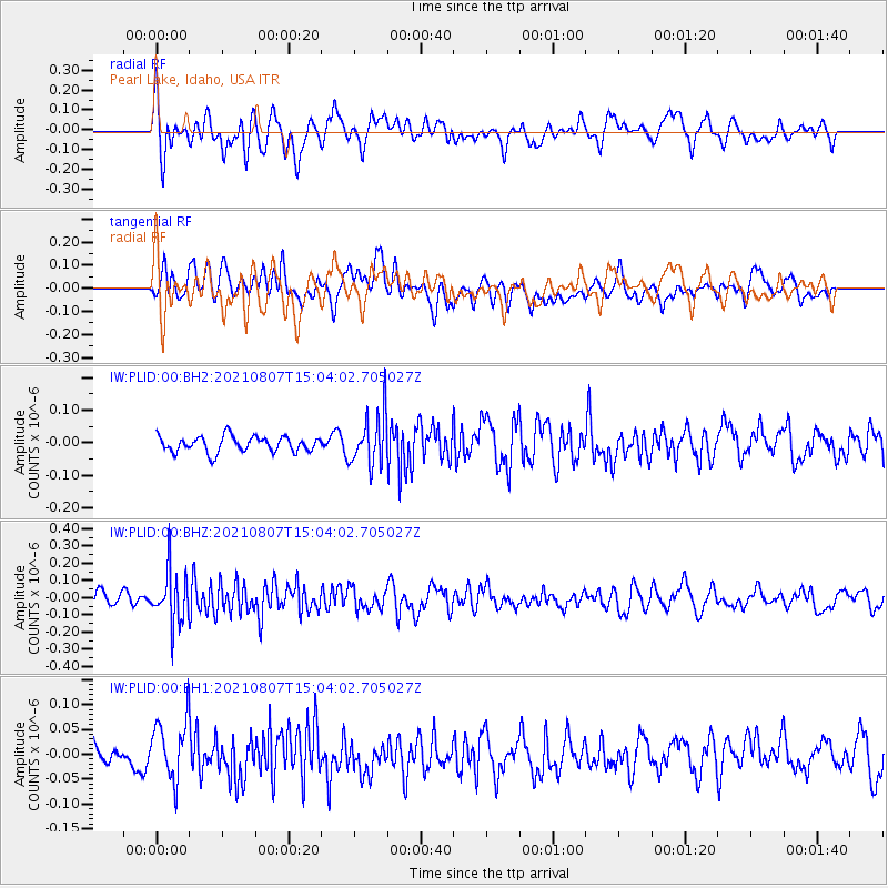
PLID Pearl Lake, Idaho, USA - Earthquake Result Viewer
*The percent match for this event was below the threshold and hence no stack was calculated.
| Earthquake location: |
Solomon Islands |
| Earthquake latitude/longitude: |
-10.1/161.1 |
| Earthquake time(UTC): |
2021/08/07 (219) 14:51:31 GMT |
| Earthquake Depth: |
61 km |
| Earthquake Magnitude: |
5.3 Mww |
| Earthquake Catalog/Contributor: |
NEIC PDE/us |
|
| Network: |
IW Intermountain West |
| Station: |
PLID Pearl Lake, Idaho, USA |
| Lat/Lon: |
45.09 N/116.00 W |
| Elevation: |
2164 m |
|
| Distance: |
92.1 deg |
| Az: |
44.703 deg |
| Baz: |
257.934 deg |
| Ray Param: |
$rayparam |
*The percent match for this event was below the threshold and hence was not used in the summary stack. |
|
| Radial Match: |
59.801186 % |
| Radial Bump: |
400 |
| Transverse Match: |
53.52875 % |
| Transverse Bump: |
400 |
| SOD ConfigId: |
25131211 |
| Insert Time: |
2021-08-21 15:03:03.080 +0000 |
| GWidth: |
2.5 |
| Max Bumps: |
400 |
| Tol: |
0.001 |
|
Signal To Noise
| Channel | StoN | STA | LTA |
| IW:PLID:00:BHZ:20210807T15:04:02.705027Z | 3.109858 | 1.509636E-7 | 4.854357E-8 |
| IW:PLID:00:BH1:20210807T15:04:02.705027Z | 2.4521804 | 6.0565085E-8 | 2.4698464E-8 |
| IW:PLID:00:BH2:20210807T15:04:02.705027Z | 3.331089 | 7.9345085E-8 | 2.3819563E-8 |
| Arrivals |
| Ps | |
| PpPs | |
| PsPs/PpSs | |


