You are here: Home > Network List > AV - Alaska Volcano Observatory Stations List
> Station MAPS Pakushin Southeast, Makushin Volcano, Alaska > Earthquake Result Viewer
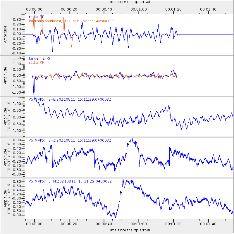
MAPS Pakushin Southeast, Makushin Volcano, Alaska - Earthquake Result Viewer
*The percent match for this event was below the threshold and hence no stack was calculated.
| Earthquake location: |
Mariana Islands Region |
| Earthquake latitude/longitude: |
15.9/147.3 |
| Earthquake time(UTC): |
2021/08/11 (223) 15:02:51 GMT |
| Earthquake Depth: |
10 km |
| Earthquake Magnitude: |
5.4 mww |
| Earthquake Catalog/Contributor: |
NEIC PDE/us |
|
| Network: |
AV Alaska Volcano Observatory |
| Station: |
MAPS Pakushin Southeast, Makushin Volcano, Alaska |
| Lat/Lon: |
53.81 N/166.94 W |
| Elevation: |
333 m |
|
| Distance: |
51.9 deg |
| Az: |
32.701 deg |
| Baz: |
241.232 deg |
| Ray Param: |
$rayparam |
*The percent match for this event was below the threshold and hence was not used in the summary stack. |
|
| Radial Match: |
53.212578 % |
| Radial Bump: |
400 |
| Transverse Match: |
79.9537 % |
| Transverse Bump: |
285 |
| SOD ConfigId: |
25131211 |
| Insert Time: |
2021-08-25 15:07:47.198 +0000 |
| GWidth: |
2.5 |
| Max Bumps: |
400 |
| Tol: |
0.001 |
|
Signal To Noise
| Channel | StoN | STA | LTA |
| AV:MAPS: :BHZ:20210811T15:11:29.040003Z | 2.0996912 | 3.6791897E-7 | 1.7522528E-7 |
| AV:MAPS: :BHN:20210811T15:11:29.040003Z | 1.6292948 | 7.9016286E-7 | 4.849723E-7 |
| AV:MAPS: :BHE:20210811T15:11:29.040003Z | 1.6158015 | 5.9557607E-7 | 3.6859487E-7 |
| Arrivals |
| Ps | |
| PpPs | |
| PsPs/PpSs | |


