You are here: Home > Network List > US - United States National Seismic Network Stations List
> Station DUG Dugway, Tooele County, Utah, USA > Earthquake Result Viewer
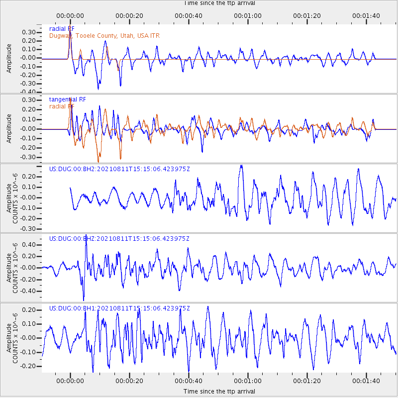
DUG Dugway, Tooele County, Utah, USA - Earthquake Result Viewer
*The percent match for this event was below the threshold and hence no stack was calculated.
| Earthquake location: |
Mariana Islands Region |
| Earthquake latitude/longitude: |
15.9/147.3 |
| Earthquake time(UTC): |
2021/08/11 (223) 15:02:51 GMT |
| Earthquake Depth: |
10 km |
| Earthquake Magnitude: |
5.4 mww |
| Earthquake Catalog/Contributor: |
NEIC PDE/us |
|
| Network: |
US United States National Seismic Network |
| Station: |
DUG Dugway, Tooele County, Utah, USA |
| Lat/Lon: |
40.19 N/112.81 W |
| Elevation: |
1477 m |
|
| Distance: |
87.3 deg |
| Az: |
49.058 deg |
| Baz: |
288.388 deg |
| Ray Param: |
$rayparam |
*The percent match for this event was below the threshold and hence was not used in the summary stack. |
|
| Radial Match: |
65.28825 % |
| Radial Bump: |
382 |
| Transverse Match: |
69.867905 % |
| Transverse Bump: |
400 |
| SOD ConfigId: |
25131211 |
| Insert Time: |
2021-08-25 15:17:13.752 +0000 |
| GWidth: |
2.5 |
| Max Bumps: |
400 |
| Tol: |
0.001 |
|
Signal To Noise
| Channel | StoN | STA | LTA |
| US:DUG:00:BHZ:20210811T15:15:06.423975Z | 3.1993809 | 1.7109888E-7 | 5.3478747E-8 |
| US:DUG:00:BH1:20210811T15:15:06.423975Z | 0.7991412 | 5.090611E-8 | 6.3701016E-8 |
| US:DUG:00:BH2:20210811T15:15:06.423975Z | 1.2014827 | 6.285059E-8 | 5.2310856E-8 |
| Arrivals |
| Ps | |
| PpPs | |
| PsPs/PpSs | |


