You are here: Home > Network List > US - United States National Seismic Network Stations List
> Station MNTX Cornudas Mountains, Texas, USA > Earthquake Result Viewer
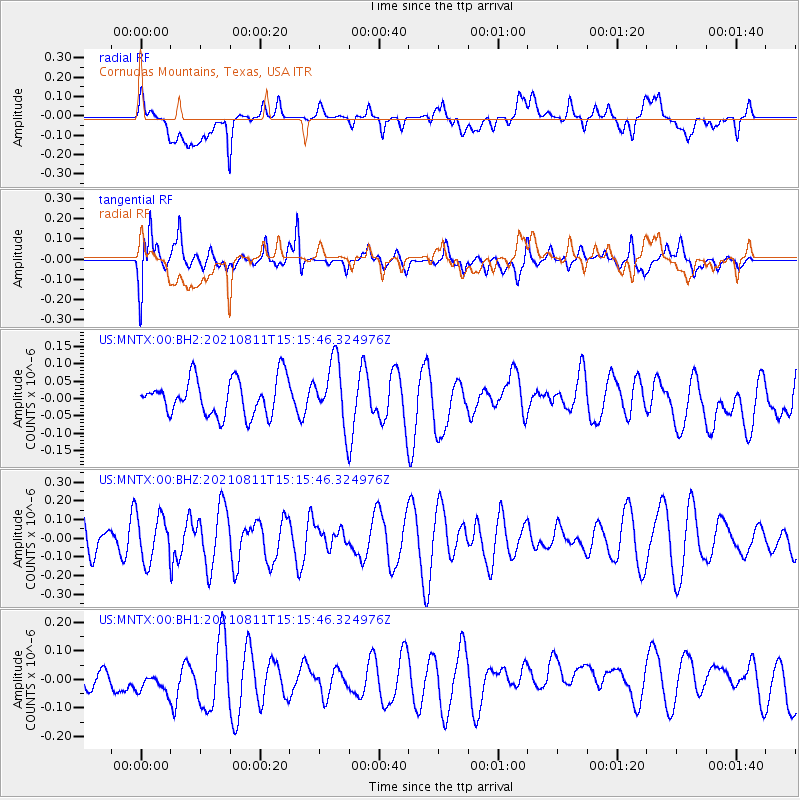
MNTX Cornudas Mountains, Texas, USA - Earthquake Result Viewer
*The percent match for this event was below the threshold and hence no stack was calculated.
| Earthquake location: |
Mariana Islands Region |
| Earthquake latitude/longitude: |
15.9/147.3 |
| Earthquake time(UTC): |
2021/08/11 (223) 15:02:51 GMT |
| Earthquake Depth: |
10 km |
| Earthquake Magnitude: |
5.4 mww |
| Earthquake Catalog/Contributor: |
NEIC PDE/us |
|
| Network: |
US United States National Seismic Network |
| Station: |
MNTX Cornudas Mountains, Texas, USA |
| Lat/Lon: |
31.70 N/105.38 W |
| Elevation: |
404 m |
|
| Distance: |
95.9 deg |
| Az: |
54.873 deg |
| Baz: |
292.587 deg |
| Ray Param: |
$rayparam |
*The percent match for this event was below the threshold and hence was not used in the summary stack. |
|
| Radial Match: |
39.01353 % |
| Radial Bump: |
400 |
| Transverse Match: |
74.4461 % |
| Transverse Bump: |
400 |
| SOD ConfigId: |
25131211 |
| Insert Time: |
2021-08-25 15:17:22.757 +0000 |
| GWidth: |
2.5 |
| Max Bumps: |
400 |
| Tol: |
0.001 |
|
Signal To Noise
| Channel | StoN | STA | LTA |
| US:MNTX:00:BHZ:20210811T15:15:46.324976Z | 1.2298642 | 1.2283763E-7 | 9.987902E-8 |
| US:MNTX:00:BH1:20210811T15:15:46.324976Z | 1.0579687 | 5.467929E-8 | 5.1683276E-8 |
| US:MNTX:00:BH2:20210811T15:15:46.324976Z | 1.7040168 | 9.0156846E-8 | 5.2908426E-8 |
| Arrivals |
| Ps | |
| PpPs | |
| PsPs/PpSs | |


