BUNG YL.BUNG - Earthquake Result Viewer
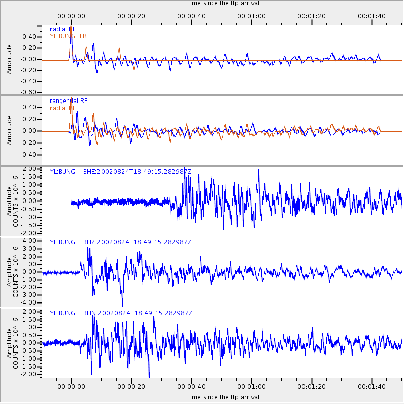
Earthquake location: Kuril Islands
Earthquake latitude/longitude: 43.1/146.1
Earthquake time(UTC): 2002/08/24 (236) 18:40:53 GMT
Earthquake Depth: 43 km
Earthquake Magnitude: 5.9 MB, 5.8 MS, 6.2 MW, 6.1 MW
Earthquake Catalog/Contributor: WHDF/NEIC
Network: YL Himalayan Nepal Tibet Experiment
Station: BUNG YL.BUNG
Lat/Lon: 27.88 N/85.89 E
Elevation: 1191 m
Distance: 50.3 deg
Az: 273.076 deg
Baz: 55.697 deg
Ray Param: 0.068042494
Estimated Moho Depth: 46.75 km
Estimated Crust Vp/Vs: 1.94
Assumed Crust Vp: 6.142 km/s
Estimated Crust Vs: 3.162 km/s
Estimated Crust Poisson's Ratio: 0.32
Radial Match: 84.4183 %
Radial Bump: 400
Transverse Match: 82.069 %
Transverse Bump: 400
SOD ConfigId: 16844
Insert Time: 2010-02-26 15:52:32.670 +0000
GWidth: 2.5
Max Bumps: 400
Tol: 0.001

Signal To Noise

ChannelStoNSTALTA
YL:BUNG: :BHZ:20020824T18:49:15.282987Z5.00491054.544798E-79.080677E-8
YL:BUNG: :BHN:20020824T18:49:15.282987Z1.51572981.9713784E-71.3006134E-7
YL:BUNG: :BHE:20020824T18:49:15.282987Z1.95139611.9761575E-71.012689E-7
Arrivals
Ps7.5 SECOND
PpPs21 SECOND
PsPs/PpSs29 SECOND