
BUNG YL.BUNG - Earthquake Result Viewer
| ||||||||||||||||||
| ||||||||||||||||||
| ||||||||||||||||||
|

Signal To Noise
| Channel | StoN | STA | LTA |
| YL:BUNG: :BHZ:20020903T14:30:10.862988Z | 6.916042 | 6.15028E-7 | 8.892774E-8 |
| YL:BUNG: :BHN:20020903T14:30:10.862988Z | 1.9896214 | 1.2504657E-7 | 6.284943E-8 |
| YL:BUNG: :BHE:20020903T14:30:10.862988Z | 3.2159624 | 2.4034122E-7 | 7.473384E-8 |
| Arrivals | |
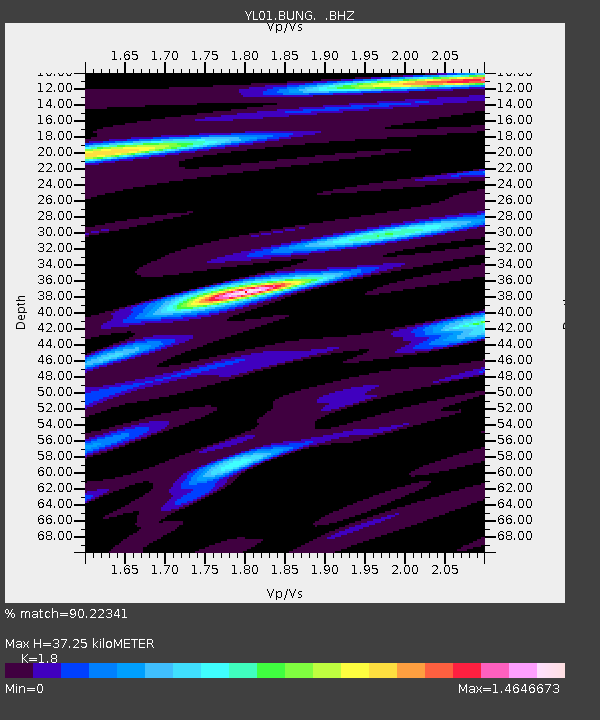
| Ps | 5.2 SECOND |
| PpPs | 16 SECOND |
| PsPs/PpSs | 21 SECOND |

