
BUNG YL.BUNG - Earthquake Result Viewer
| ||||||||||||||||||
| ||||||||||||||||||
| ||||||||||||||||||
|

Signal To Noise
| Channel | StoN | STA | LTA |
| YL:BUNG: :BHZ:20021010T10:59:21.116021Z | 14.993775 | 1.9833124E-6 | 1.3227572E-7 |
| YL:BUNG: :BHN:20021010T10:59:21.116021Z | 5.195636 | 4.4580275E-7 | 8.5803315E-8 |
| YL:BUNG: :BHE:20021010T10:59:21.116021Z | 10.035889 | 9.606836E-7 | 9.5724815E-8 |
| Arrivals | |
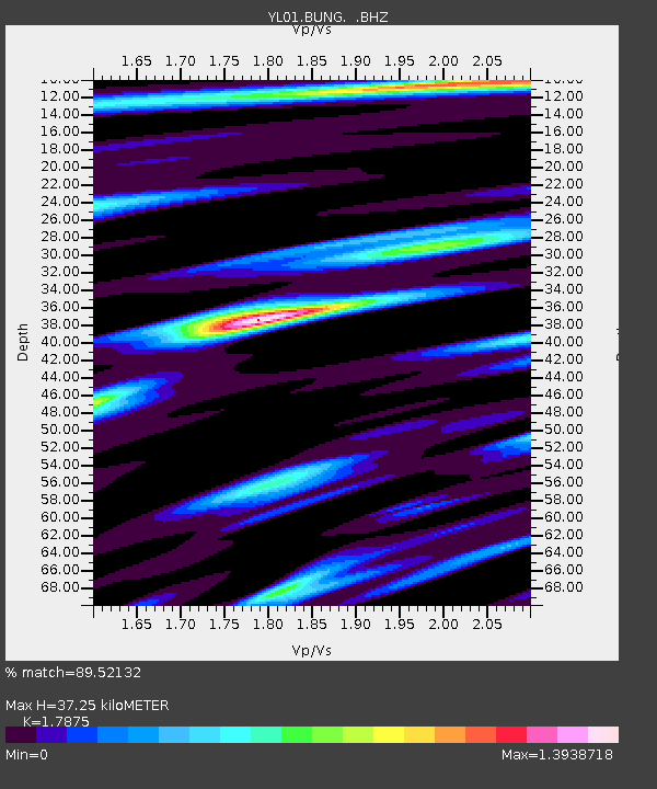
| Ps | 5.0 SECOND |
| PpPs | 16 SECOND |
| PsPs/PpSs | 21 SECOND |

