You are here: Home > Network List > AK - Alaska Regional Network Stations List
> Station MDM Murphy Dome > Earthquake Result Viewer
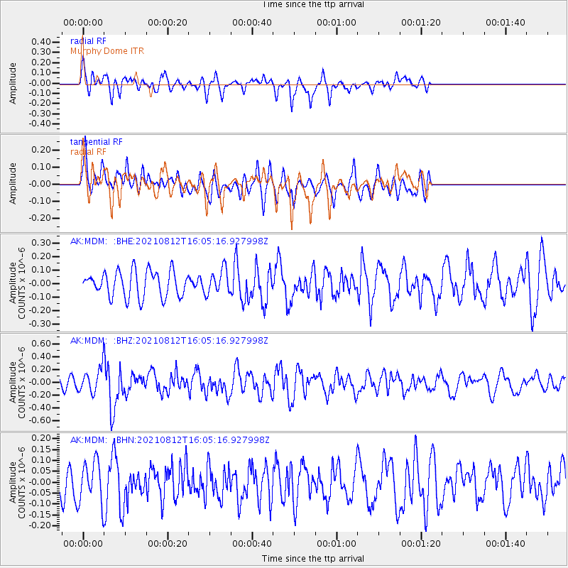
MDM Murphy Dome - Earthquake Result Viewer
*The percent match for this event was below the threshold and hence no stack was calculated.
| Earthquake location: |
Philippine Islands Region |
| Earthquake latitude/longitude: |
6.3/127.4 |
| Earthquake time(UTC): |
2021/08/12 (224) 15:53:28 GMT |
| Earthquake Depth: |
10 km |
| Earthquake Magnitude: |
5.7 mww |
| Earthquake Catalog/Contributor: |
NEIC PDE/us |
|
| Network: |
AK Alaska Regional Network |
| Station: |
MDM Murphy Dome |
| Lat/Lon: |
64.96 N/148.23 W |
| Elevation: |
634 m |
|
| Distance: |
82.0 deg |
| Az: |
25.326 deg |
| Baz: |
267.592 deg |
| Ray Param: |
$rayparam |
*The percent match for this event was below the threshold and hence was not used in the summary stack. |
|
| Radial Match: |
51.57978 % |
| Radial Bump: |
400 |
| Transverse Match: |
59.166485 % |
| Transverse Bump: |
400 |
| SOD ConfigId: |
25131211 |
| Insert Time: |
2021-08-26 15:54:46.155 +0000 |
| GWidth: |
2.5 |
| Max Bumps: |
400 |
| Tol: |
0.001 |
|
Signal To Noise
| Channel | StoN | STA | LTA |
| AK:MDM: :BHZ:20210812T16:05:16.927998Z | 2.6422403 | 1.8311388E-7 | 6.930251E-8 |
| AK:MDM: :BHN:20210812T16:05:16.927998Z | 2.1974306 | 9.434152E-8 | 4.2932655E-8 |
| AK:MDM: :BHE:20210812T16:05:16.927998Z | 0.948136 | 9.145747E-8 | 9.646029E-8 |
| Arrivals |
| Ps | |
| PpPs | |
| PsPs/PpSs | |


