You are here: Home > Network List > C8 - Canadian Seismic Research Network () Stations List
> Station GRIB Gribbell Island, BC, CA > Earthquake Result Viewer
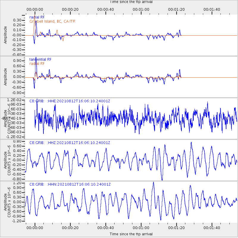
GRIB Gribbell Island, BC, CA - Earthquake Result Viewer
*The percent match for this event was below the threshold and hence no stack was calculated.
| Earthquake location: |
Philippine Islands Region |
| Earthquake latitude/longitude: |
6.3/127.4 |
| Earthquake time(UTC): |
2021/08/12 (224) 15:53:28 GMT |
| Earthquake Depth: |
10 km |
| Earthquake Magnitude: |
5.7 mww |
| Earthquake Catalog/Contributor: |
NEIC PDE/us |
|
| Network: |
C8 Canadian Seismic Research Network () |
| Station: |
GRIB Gribbell Island, BC, CA |
| Lat/Lon: |
53.34 N/129.14 W |
| Elevation: |
418 m |
|
| Distance: |
93.0 deg |
| Az: |
35.727 deg |
| Baz: |
284.539 deg |
| Ray Param: |
$rayparam |
*The percent match for this event was below the threshold and hence was not used in the summary stack. |
|
| Radial Match: |
55.164085 % |
| Radial Bump: |
400 |
| Transverse Match: |
55.44818 % |
| Transverse Bump: |
400 |
| SOD ConfigId: |
25131211 |
| Insert Time: |
2021-08-26 15:56:48.275 +0000 |
| GWidth: |
2.5 |
| Max Bumps: |
400 |
| Tol: |
0.001 |
|
Signal To Noise
| Channel | StoN | STA | LTA |
| C8:GRIB: :HHZ:20210812T16:06:10.24001Z | 0.79035443 | 1.8281344E-7 | 2.3130563E-7 |
| C8:GRIB: :HHN:20210812T16:06:10.24001Z | 1.4638691 | 5.080533E-7 | 3.4706198E-7 |
| C8:GRIB: :HHE:20210812T16:06:10.24001Z | 0.8632429 | 3.3618317E-9 | 3.8944212E-9 |
| Arrivals |
| Ps | |
| PpPs | |
| PsPs/PpSs | |


