BUNG YL.BUNG - Earthquake Result Viewer
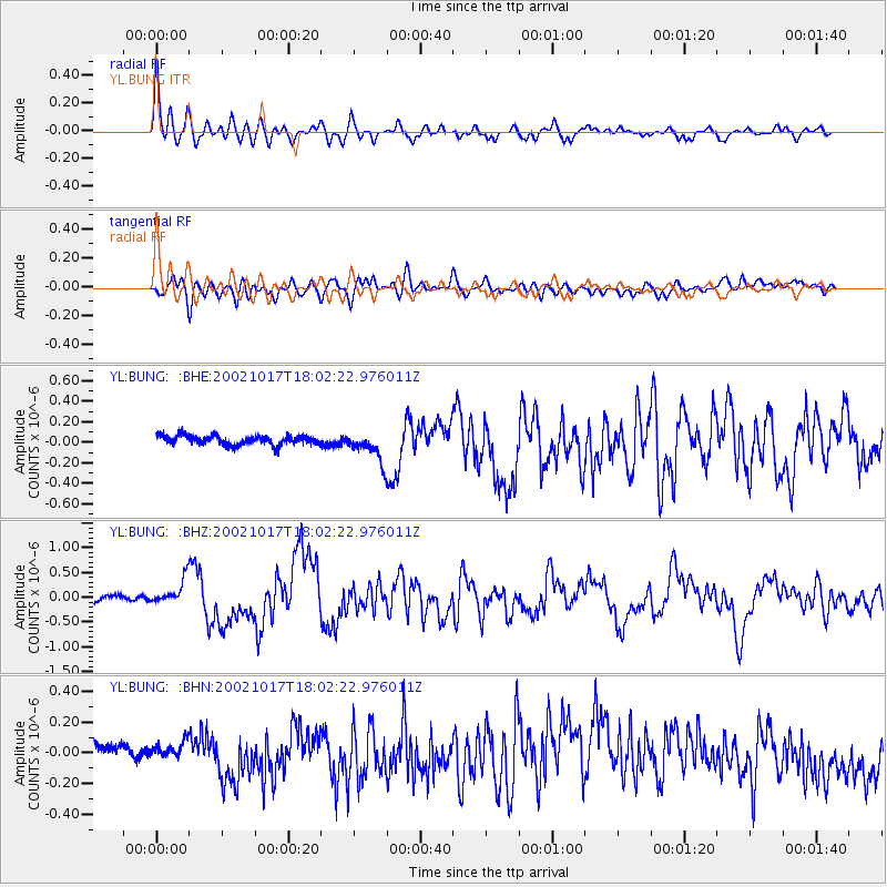
Earthquake location: Irian Jaya, Indonesia
Earthquake latitude/longitude: -3.6/140.2
Earthquake time(UTC): 2002/10/17 (290) 17:52:44 GMT
Earthquake Depth: 33 km
Earthquake Magnitude: 5.6 MB, 6.2 MS, 6.3 MW, 6.3 MW
Earthquake Catalog/Contributor: WHDF/NEIC
Network: YL Himalayan Nepal Tibet Experiment
Station: BUNG YL.BUNG
Lat/Lon: 27.88 N/85.89 E
Elevation: 1191 m
Distance: 60.9 deg
Az: 304.613 deg
Baz: 111.892 deg
Ray Param: 0.061162308
Estimated Moho Depth: 36.5 km
Estimated Crust Vp/Vs: 1.79
Assumed Crust Vp: 6.142 km/s
Estimated Crust Vs: 3.441 km/s
Estimated Crust Poisson's Ratio: 0.27
Radial Match: 88.97328 %
Radial Bump: 400
Transverse Match: 73.14714 %
Transverse Bump: 400
SOD ConfigId: 16844
Insert Time: 2010-02-26 15:52:44.433 +0000
GWidth: 2.5
Max Bumps: 400
Tol: 0.001

Signal To Noise

ChannelStoNSTALTA
YL:BUNG: :BHZ:20021017T18:02:22.976011Z5.5420632.5103026E-74.5295454E-8
YL:BUNG: :BHN:20021017T18:02:22.976011Z1.02187254.735117E-84.6337647E-8
YL:BUNG: :BHE:20021017T18:02:22.976011Z3.34413171.4762662E-74.414498E-8
Arrivals
Ps4.9 SECOND
PpPs16 SECOND
PsPs/PpSs21 SECOND