You are here: Home > Network List > TX - Texas Seismological Network Stations List
> Station WTFS Witchita Falls > Earthquake Result Viewer
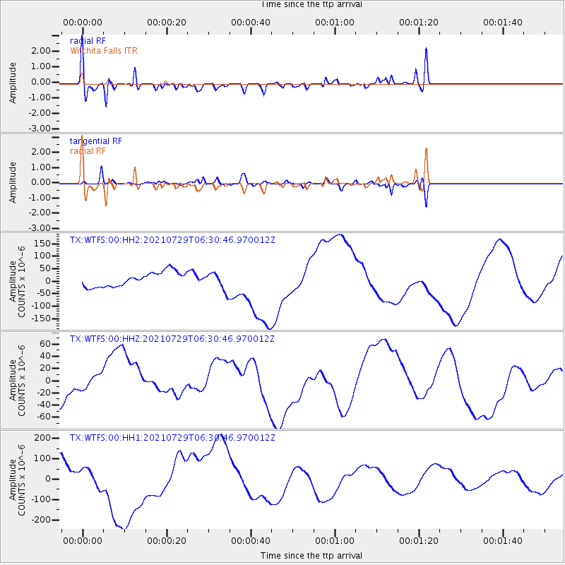
WTFS Witchita Falls - Earthquake Result Viewer
*The percent match for this event was below the threshold and hence no stack was calculated.
| Earthquake location: |
South Of Alaska |
| Earthquake latitude/longitude: |
55.9/-157.0 |
| Earthquake time(UTC): |
2021/07/29 (210) 06:23:02 GMT |
| Earthquake Depth: |
35 km |
| Earthquake Magnitude: |
5.7 mb |
| Earthquake Catalog/Contributor: |
NEIC PDE/us |
|
| Network: |
TX Texas Seismological Network |
| Station: |
WTFS Witchita Falls |
| Lat/Lon: |
33.77 N/98.46 W |
| Elevation: |
277 m |
|
| Distance: |
45.4 deg |
| Az: |
93.824 deg |
| Baz: |
317.544 deg |
| Ray Param: |
$rayparam |
*The percent match for this event was below the threshold and hence was not used in the summary stack. |
|
| Radial Match: |
58.559784 % |
| Radial Bump: |
400 |
| Transverse Match: |
53.64952 % |
| Transverse Bump: |
400 |
| SOD ConfigId: |
25131211 |
| Insert Time: |
2021-08-27 02:17:34.387 +0000 |
| GWidth: |
2.5 |
| Max Bumps: |
400 |
| Tol: |
0.001 |
|
Signal To Noise
| Channel | StoN | STA | LTA |
| TX:WTFS:00:HHZ:20210729T06:30:46.970012Z | 0.93721074 | 1.3686893E-5 | 1.4603858E-5 |
| TX:WTFS:00:HH1:20210729T06:30:46.970012Z | 0.98621273 | 4.4889235E-5 | 4.551679E-5 |
| TX:WTFS:00:HH2:20210729T06:30:46.970012Z | 1.2434698 | 3.611694E-5 | 2.9045288E-5 |
| Arrivals |
| Ps | |
| PpPs | |
| PsPs/PpSs | |


