You are here: Home > Network List > G - GEOSCOPE Stations List
> Station MPG Montagne des Peres, French Guyana > Earthquake Result Viewer
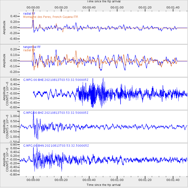
MPG Montagne des Peres, French Guyana - Earthquake Result Viewer
*The percent match for this event was below the threshold and hence no stack was calculated.
| Earthquake location: |
South Sandwich Islands Region |
| Earthquake latitude/longitude: |
-58.1/-25.4 |
| Earthquake time(UTC): |
2021/08/13 (225) 03:43:19 GMT |
| Earthquake Depth: |
66 km |
| Earthquake Magnitude: |
5.7 mb |
| Earthquake Catalog/Contributor: |
NEIC PDE/us |
|
| Network: |
G GEOSCOPE |
| Station: |
MPG Montagne des Peres, French Guyana |
| Lat/Lon: |
5.11 N/52.64 W |
| Elevation: |
147 m |
|
| Distance: |
66.7 deg |
| Az: |
330.241 deg |
| Baz: |
164.637 deg |
| Ray Param: |
$rayparam |
*The percent match for this event was below the threshold and hence was not used in the summary stack. |
|
| Radial Match: |
58.567486 % |
| Radial Bump: |
400 |
| Transverse Match: |
52.008293 % |
| Transverse Bump: |
400 |
| SOD ConfigId: |
25131211 |
| Insert Time: |
2021-08-27 03:46:03.226 +0000 |
| GWidth: |
2.5 |
| Max Bumps: |
400 |
| Tol: |
0.001 |
|
Signal To Noise
| Channel | StoN | STA | LTA |
| G:MPG:00:BHZ:20210813T03:53:32.500005Z | 6.082305 | 5.6246836E-7 | 9.2476185E-8 |
| G:MPG:00:BHN:20210813T03:53:32.500005Z | 5.2077 | 2.9185236E-7 | 5.604247E-8 |
| G:MPG:00:BHE:20210813T03:53:32.500005Z | 1.7885214 | 1.5800053E-7 | 8.834142E-8 |
| Arrivals |
| Ps | |
| PpPs | |
| PsPs/PpSs | |


