You are here: Home > Network List > US - United States National Seismic Network Stations List
> Station HAWA Hanford, Washington, USA > Earthquake Result Viewer
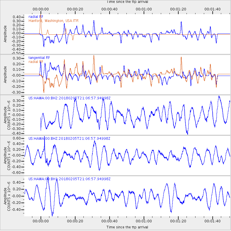
HAWA Hanford, Washington, USA - Earthquake Result Viewer
*The percent match for this event was below the threshold and hence no stack was calculated.
| Earthquake location: |
Bonin Islands, Japan Region |
| Earthquake latitude/longitude: |
27.0/140.2 |
| Earthquake time(UTC): |
2018/02/05 (036) 20:56:22 GMT |
| Earthquake Depth: |
465 km |
| Earthquake Magnitude: |
5.3 Mww |
| Earthquake Catalog/Contributor: |
NEIC PDE/us |
|
| Network: |
US United States National Seismic Network |
| Station: |
HAWA Hanford, Washington, USA |
| Lat/Lon: |
46.39 N/119.53 W |
| Elevation: |
364 m |
|
| Distance: |
77.5 deg |
| Az: |
44.225 deg |
| Baz: |
295.953 deg |
| Ray Param: |
$rayparam |
*The percent match for this event was below the threshold and hence was not used in the summary stack. |
|
| Radial Match: |
65.478745 % |
| Radial Bump: |
400 |
| Transverse Match: |
36.039867 % |
| Transverse Bump: |
400 |
| SOD ConfigId: |
2546091 |
| Insert Time: |
2018-02-19 20:59:02.944 +0000 |
| GWidth: |
2.5 |
| Max Bumps: |
400 |
| Tol: |
0.001 |
|
Signal To Noise
| Channel | StoN | STA | LTA |
| US:HAWA:00:BHZ:20180205T21:06:57.94998Z | 0.9715429 | 2.1743672E-7 | 2.2380559E-7 |
| US:HAWA:00:BH1:20180205T21:06:57.94998Z | 3.3536959 | 3.149267E-7 | 9.3904376E-8 |
| US:HAWA:00:BH2:20180205T21:06:57.94998Z | 0.8786873 | 1.486529E-7 | 1.691761E-7 |
| Arrivals |
| Ps | |
| PpPs | |
| PsPs/PpSs | |


