You are here: Home > Network List > US - United States National Seismic Network Stations List
> Station HAWA Hanford, Washington, USA > Earthquake Result Viewer
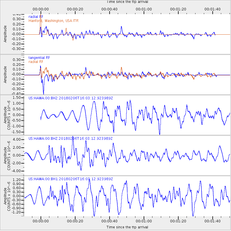
HAWA Hanford, Washington, USA - Earthquake Result Viewer
*The percent match for this event was below the threshold and hence no stack was calculated.
| Earthquake location: |
Taiwan |
| Earthquake latitude/longitude: |
24.2/121.7 |
| Earthquake time(UTC): |
2018/02/06 (037) 15:50:41 GMT |
| Earthquake Depth: |
9.5 km |
| Earthquake Magnitude: |
6.4 Mww |
| Earthquake Catalog/Contributor: |
NEIC PDE/us |
|
| Network: |
US United States National Seismic Network |
| Station: |
HAWA Hanford, Washington, USA |
| Lat/Lon: |
46.39 N/119.53 W |
| Elevation: |
364 m |
|
| Distance: |
90.6 deg |
| Az: |
37.346 deg |
| Baz: |
306.813 deg |
| Ray Param: |
$rayparam |
*The percent match for this event was below the threshold and hence was not used in the summary stack. |
|
| Radial Match: |
51.293568 % |
| Radial Bump: |
400 |
| Transverse Match: |
72.551155 % |
| Transverse Bump: |
400 |
| SOD ConfigId: |
2546091 |
| Insert Time: |
2018-02-20 15:52:58.443 +0000 |
| GWidth: |
2.5 |
| Max Bumps: |
400 |
| Tol: |
0.001 |
|
Signal To Noise
| Channel | StoN | STA | LTA |
| US:HAWA:00:BHZ:20180206T16:03:12.923989Z | 1.8267734 | 8.8571517E-7 | 4.8485225E-7 |
| US:HAWA:00:BH1:20180206T16:03:12.923989Z | 1.6720244 | 4.3725086E-7 | 2.6150985E-7 |
| US:HAWA:00:BH2:20180206T16:03:12.923989Z | 2.857025 | 8.882791E-7 | 3.109105E-7 |
| Arrivals |
| Ps | |
| PpPs | |
| PsPs/PpSs | |


