You are here: Home > Network List > C8 - Canadian Seismic Research Network () Stations List
> Station GRIB Gribbell Island, BC, CA > Earthquake Result Viewer
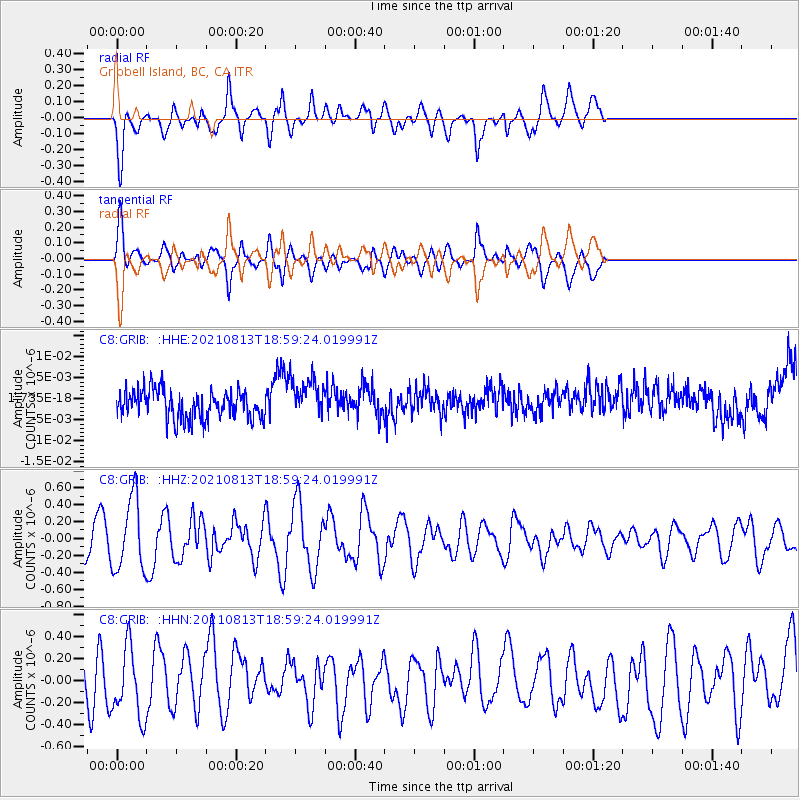
GRIB Gribbell Island, BC, CA - Earthquake Result Viewer
*The percent match for this event was below the threshold and hence no stack was calculated.
| Earthquake location: |
Kermadec Islands Region |
| Earthquake latitude/longitude: |
-27.5/-177.0 |
| Earthquake time(UTC): |
2021/08/13 (225) 18:46:53 GMT |
| Earthquake Depth: |
14 km |
| Earthquake Magnitude: |
5.5 Mww |
| Earthquake Catalog/Contributor: |
NEIC PDE/us |
|
| Network: |
C8 Canadian Seismic Research Network () |
| Station: |
GRIB Gribbell Island, BC, CA |
| Lat/Lon: |
53.34 N/129.14 W |
| Elevation: |
418 m |
|
| Distance: |
90.6 deg |
| Az: |
26.404 deg |
| Baz: |
221.196 deg |
| Ray Param: |
$rayparam |
*The percent match for this event was below the threshold and hence was not used in the summary stack. |
|
| Radial Match: |
45.754337 % |
| Radial Bump: |
352 |
| Transverse Match: |
45.719578 % |
| Transverse Bump: |
352 |
| SOD ConfigId: |
25131211 |
| Insert Time: |
2021-08-27 18:52:34.942 +0000 |
| GWidth: |
2.5 |
| Max Bumps: |
400 |
| Tol: |
0.001 |
|
Signal To Noise
| Channel | StoN | STA | LTA |
| C8:GRIB: :HHZ:20210813T18:59:24.019991Z | 2.2808745 | 4.2269235E-7 | 1.8532029E-7 |
| C8:GRIB: :HHN:20210813T18:59:24.019991Z | 1.2483639 | 3.1645638E-7 | 2.534969E-7 |
| C8:GRIB: :HHE:20210813T18:59:24.019991Z | 1.4395877 | 4.8669184E-9 | 3.3807723E-9 |
| Arrivals |
| Ps | |
| PpPs | |
| PsPs/PpSs | |


