You are here: Home > Network List > US - United States National Seismic Network Stations List
> Station MNTX Cornudas Mountains, Texas, USA > Earthquake Result Viewer
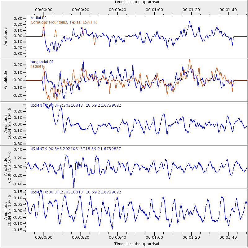
MNTX Cornudas Mountains, Texas, USA - Earthquake Result Viewer
*The percent match for this event was below the threshold and hence no stack was calculated.
| Earthquake location: |
Kermadec Islands Region |
| Earthquake latitude/longitude: |
-27.5/-177.0 |
| Earthquake time(UTC): |
2021/08/13 (225) 18:46:53 GMT |
| Earthquake Depth: |
14 km |
| Earthquake Magnitude: |
5.5 Mww |
| Earthquake Catalog/Contributor: |
NEIC PDE/us |
|
| Network: |
US United States National Seismic Network |
| Station: |
MNTX Cornudas Mountains, Texas, USA |
| Lat/Lon: |
31.70 N/105.38 W |
| Elevation: |
404 m |
|
| Distance: |
90.1 deg |
| Az: |
53.989 deg |
| Baz: |
237.443 deg |
| Ray Param: |
$rayparam |
*The percent match for this event was below the threshold and hence was not used in the summary stack. |
|
| Radial Match: |
34.689396 % |
| Radial Bump: |
400 |
| Transverse Match: |
37.05694 % |
| Transverse Bump: |
400 |
| SOD ConfigId: |
25131211 |
| Insert Time: |
2021-08-27 19:02:14.009 +0000 |
| GWidth: |
2.5 |
| Max Bumps: |
400 |
| Tol: |
0.001 |
|
Signal To Noise
| Channel | StoN | STA | LTA |
| US:MNTX:00:BHZ:20210813T18:59:21.673982Z | 0.99178505 | 6.3177595E-8 | 6.3700895E-8 |
| US:MNTX:00:BH1:20210813T18:59:21.673982Z | 1.5722132 | 1.14322106E-7 | 7.271413E-8 |
| US:MNTX:00:BH2:20210813T18:59:21.673982Z | 0.6900925 | 9.424562E-8 | 1.3656954E-7 |
| Arrivals |
| Ps | |
| PpPs | |
| PsPs/PpSs | |


