You are here: Home > Network List > UW - Pacific Northwest Regional Seismic Network Stations List
> Station UMAT Pilot Rock, OR, USA > Earthquake Result Viewer
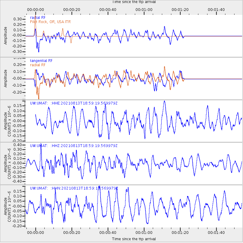
UMAT Pilot Rock, OR, USA - Earthquake Result Viewer
*The percent match for this event was below the threshold and hence no stack was calculated.
| Earthquake location: |
Kermadec Islands Region |
| Earthquake latitude/longitude: |
-27.5/-177.0 |
| Earthquake time(UTC): |
2021/08/13 (225) 18:46:53 GMT |
| Earthquake Depth: |
14 km |
| Earthquake Magnitude: |
5.5 Mww |
| Earthquake Catalog/Contributor: |
NEIC PDE/us |
|
| Network: |
UW Pacific Northwest Regional Seismic Network |
| Station: |
UMAT Pilot Rock, OR, USA |
| Lat/Lon: |
45.29 N/118.96 W |
| Elevation: |
1318 m |
|
| Distance: |
89.6 deg |
| Az: |
36.792 deg |
| Baz: |
228.9 deg |
| Ray Param: |
$rayparam |
*The percent match for this event was below the threshold and hence was not used in the summary stack. |
|
| Radial Match: |
58.742077 % |
| Radial Bump: |
400 |
| Transverse Match: |
53.528095 % |
| Transverse Bump: |
390 |
| SOD ConfigId: |
25131211 |
| Insert Time: |
2021-08-27 19:03:41.062 +0000 |
| GWidth: |
2.5 |
| Max Bumps: |
400 |
| Tol: |
0.001 |
|
Signal To Noise
| Channel | StoN | STA | LTA |
| UW:UMAT: :HHZ:20210813T18:59:19.569979Z | 2.109959 | 1.644771E-7 | 7.7952755E-8 |
| UW:UMAT: :HHN:20210813T18:59:19.569979Z | 1.1163496 | 4.8734844E-8 | 4.365554E-8 |
| UW:UMAT: :HHE:20210813T18:59:19.569979Z | 0.9547063 | 6.626681E-8 | 6.941067E-8 |
| Arrivals |
| Ps | |
| PpPs | |
| PsPs/PpSs | |


