You are here: Home > Network List > WY - Yellowstone Wyoming Seismic Network Stations List
> Station YHH Holmes Hill, YNP, WY, USA > Earthquake Result Viewer
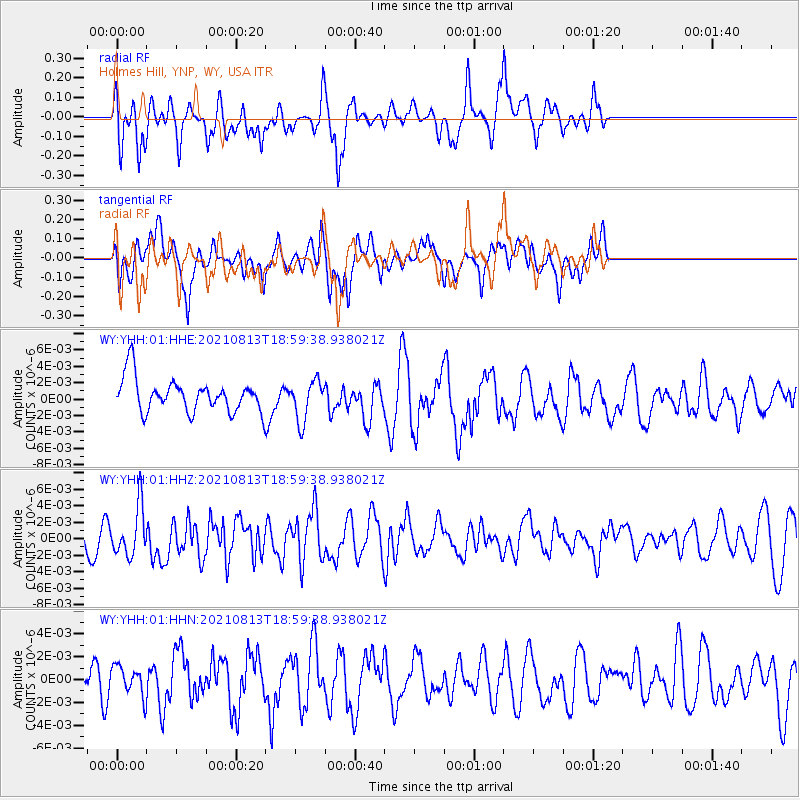
YHH Holmes Hill, YNP, WY, USA - Earthquake Result Viewer
*The percent match for this event was below the threshold and hence no stack was calculated.
| Earthquake location: |
Kermadec Islands Region |
| Earthquake latitude/longitude: |
-27.5/-177.0 |
| Earthquake time(UTC): |
2021/08/13 (225) 18:46:53 GMT |
| Earthquake Depth: |
14 km |
| Earthquake Magnitude: |
5.5 Mww |
| Earthquake Catalog/Contributor: |
NEIC PDE/us |
|
| Network: |
WY Yellowstone Wyoming Seismic Network |
| Station: |
YHH Holmes Hill, YNP, WY, USA |
| Lat/Lon: |
44.79 N/110.85 W |
| Elevation: |
2717 m |
|
| Distance: |
93.8 deg |
| Az: |
40.748 deg |
| Baz: |
234.503 deg |
| Ray Param: |
$rayparam |
*The percent match for this event was below the threshold and hence was not used in the summary stack. |
|
| Radial Match: |
58.924465 % |
| Radial Bump: |
392 |
| Transverse Match: |
46.782383 % |
| Transverse Bump: |
400 |
| SOD ConfigId: |
25131211 |
| Insert Time: |
2021-08-27 19:04:00.661 +0000 |
| GWidth: |
2.5 |
| Max Bumps: |
400 |
| Tol: |
0.001 |
|
Signal To Noise
| Channel | StoN | STA | LTA |
| WY:YHH:01:HHZ:20210813T18:59:38.938021Z | 1.8913614 | 2.9819442E-9 | 1.5766126E-9 |
| WY:YHH:01:HHN:20210813T18:59:38.938021Z | 0.6458686 | 1.2701987E-9 | 1.966652E-9 |
| WY:YHH:01:HHE:20210813T18:59:38.938021Z | 1.2301961 | 2.476567E-9 | 2.013148E-9 |
| Arrivals |
| Ps | |
| PpPs | |
| PsPs/PpSs | |


