You are here: Home > Network List > GS - US Geological Survey Networks Stations List
> Station DEC06 Boomer > Earthquake Result Viewer
DEC06 Boomer - Earthquake Result Viewer
*The percent match for this event was below the threshold and hence no stack was calculated.
| Earthquake location: |
Greenland Sea |
| Earthquake latitude/longitude: |
79.8/2.0 |
| Earthquake time(UTC): |
2018/02/08 (039) 02:29:14 GMT |
| Earthquake Depth: |
10 km |
| Earthquake Magnitude: |
5.6 Mww |
| Earthquake Catalog/Contributor: |
NEIC PDE/us |
|
| Network: |
GS US Geological Survey Networks |
| Station: |
DEC06 Boomer |
| Lat/Lon: |
39.90 N/88.95 W |
| Elevation: |
215 m |
|
| Distance: |
51.2 deg |
| Az: |
279.354 deg |
| Baz: |
13.206 deg |
| Ray Param: |
$rayparam |
*The percent match for this event was below the threshold and hence was not used in the summary stack. |
|
| Radial Match: |
43.566216 % |
| Radial Bump: |
400 |
| Transverse Match: |
63.280537 % |
| Transverse Bump: |
400 |
| SOD ConfigId: |
2546091 |
| Insert Time: |
2018-02-22 02:32:57.298 +0000 |
| GWidth: |
2.5 |
| Max Bumps: |
400 |
| Tol: |
0.001 |
|
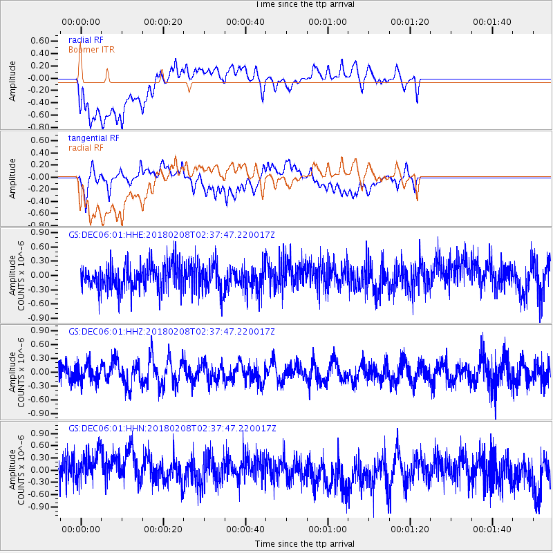
Signal To Noise
| Channel | StoN | STA | LTA |
| GS:DEC06:01:HHZ:20180208T02:37:47.220017Z | 1.0283123 | 1.9222978E-7 | 1.8693714E-7 |
| GS:DEC06:01:HHN:20180208T02:37:47.220017Z | 2.0313025 | 6.672484E-7 | 3.2848305E-7 |
| GS:DEC06:01:HHE:20180208T02:37:47.220017Z | 1.1400853 | 2.9941097E-7 | 2.6262157E-7 |
| Arrivals |
| Ps | |
| PpPs | |
| PsPs/PpSs | |


