You are here: Home > Network List > AV - Alaska Volcano Observatory Stations List
> Station SPCR Ckakachatna River, Mount Spurr, Alaska > Earthquake Result Viewer
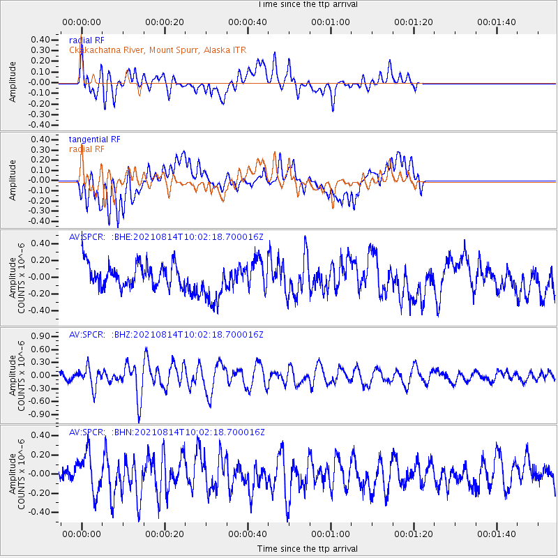
SPCR Ckakachatna River, Mount Spurr, Alaska - Earthquake Result Viewer
*The percent match for this event was below the threshold and hence no stack was calculated.
| Earthquake location: |
Tonga Islands Region |
| Earthquake latitude/longitude: |
-22.4/-174.6 |
| Earthquake time(UTC): |
2021/08/14 (226) 09:50:13 GMT |
| Earthquake Depth: |
10 km |
| Earthquake Magnitude: |
5.5 mww |
| Earthquake Catalog/Contributor: |
NEIC PDE/us |
|
| Network: |
AV Alaska Volcano Observatory |
| Station: |
SPCR Ckakachatna River, Mount Spurr, Alaska |
| Lat/Lon: |
61.20 N/152.21 W |
| Elevation: |
984 m |
|
| Distance: |
85.3 deg |
| Az: |
10.644 deg |
| Baz: |
200.667 deg |
| Ray Param: |
$rayparam |
*The percent match for this event was below the threshold and hence was not used in the summary stack. |
|
| Radial Match: |
56.14052 % |
| Radial Bump: |
400 |
| Transverse Match: |
41.87003 % |
| Transverse Bump: |
400 |
| SOD ConfigId: |
25131211 |
| Insert Time: |
2021-08-28 09:56:07.764 +0000 |
| GWidth: |
2.5 |
| Max Bumps: |
400 |
| Tol: |
0.001 |
|
Signal To Noise
| Channel | StoN | STA | LTA |
| AV:SPCR: :BHZ:20210814T10:02:18.700016Z | 2.357425 | 2.2827376E-7 | 9.6831826E-8 |
| AV:SPCR: :BHN:20210814T10:02:18.700016Z | 2.4891853 | 2.1633605E-7 | 8.6910376E-8 |
| AV:SPCR: :BHE:20210814T10:02:18.700016Z | 1.9612755 | 2.6640114E-7 | 1.3583056E-7 |
| Arrivals |
| Ps | |
| PpPs | |
| PsPs/PpSs | |


