You are here: Home > Network List > US - United States National Seismic Network Stations List
> Station AMTX Amarillo, Texas, USA > Earthquake Result Viewer
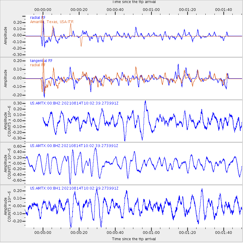
AMTX Amarillo, Texas, USA - Earthquake Result Viewer
*The percent match for this event was below the threshold and hence no stack was calculated.
| Earthquake location: |
Tonga Islands Region |
| Earthquake latitude/longitude: |
-22.4/-174.6 |
| Earthquake time(UTC): |
2021/08/14 (226) 09:50:13 GMT |
| Earthquake Depth: |
10 km |
| Earthquake Magnitude: |
5.5 mww |
| Earthquake Catalog/Contributor: |
NEIC PDE/us |
|
| Network: |
US United States National Seismic Network |
| Station: |
AMTX Amarillo, Texas, USA |
| Lat/Lon: |
34.53 N/101.41 W |
| Elevation: |
1010 m |
|
| Distance: |
89.6 deg |
| Az: |
52.199 deg |
| Baz: |
242.32 deg |
| Ray Param: |
$rayparam |
*The percent match for this event was below the threshold and hence was not used in the summary stack. |
|
| Radial Match: |
42.89021 % |
| Radial Bump: |
400 |
| Transverse Match: |
63.0249 % |
| Transverse Bump: |
400 |
| SOD ConfigId: |
25131211 |
| Insert Time: |
2021-08-28 10:07:54.085 +0000 |
| GWidth: |
2.5 |
| Max Bumps: |
400 |
| Tol: |
0.001 |
|
Signal To Noise
| Channel | StoN | STA | LTA |
| US:AMTX:00:BHZ:20210814T10:02:39.273991Z | 2.6264627 | 2.4981898E-7 | 9.5116135E-8 |
| US:AMTX:00:BH1:20210814T10:02:39.273991Z | 0.4347769 | 5.103718E-8 | 1.1738705E-7 |
| US:AMTX:00:BH2:20210814T10:02:39.273991Z | 1.3138219 | 1.1944896E-7 | 9.0917155E-8 |
| Arrivals |
| Ps | |
| PpPs | |
| PsPs/PpSs | |


