You are here: Home > Network List > UW - Pacific Northwest Regional Seismic Network Stations List
> Station IRON Crane, OR, USA > Earthquake Result Viewer
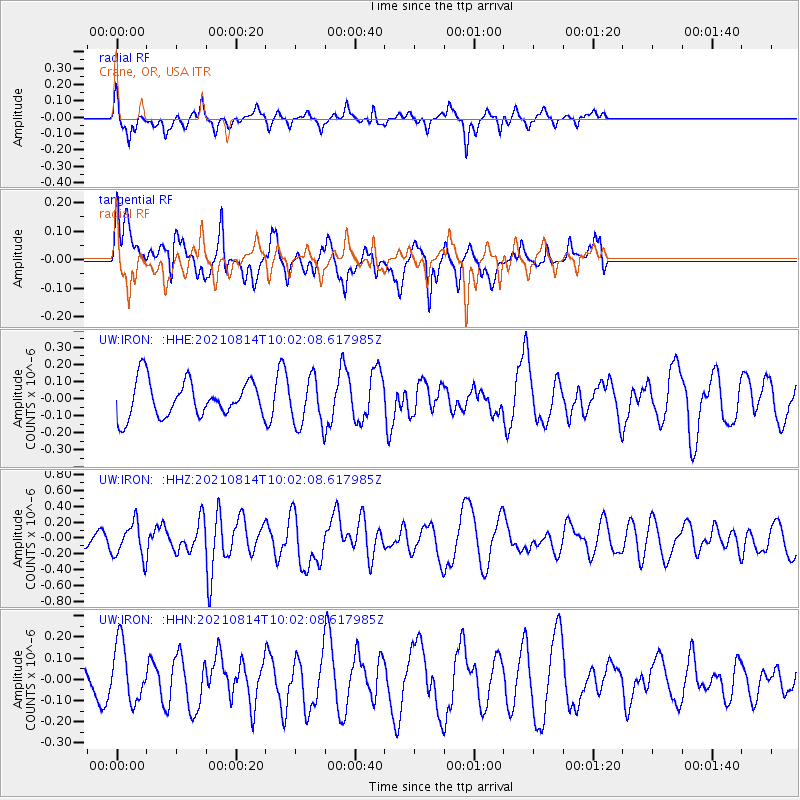
IRON Crane, OR, USA - Earthquake Result Viewer
*The percent match for this event was below the threshold and hence no stack was calculated.
| Earthquake location: |
Tonga Islands Region |
| Earthquake latitude/longitude: |
-22.4/-174.6 |
| Earthquake time(UTC): |
2021/08/14 (226) 09:50:13 GMT |
| Earthquake Depth: |
10 km |
| Earthquake Magnitude: |
5.5 mww |
| Earthquake Catalog/Contributor: |
NEIC PDE/us |
|
| Network: |
UW Pacific Northwest Regional Seismic Network |
| Station: |
IRON Crane, OR, USA |
| Lat/Lon: |
43.36 N/118.47 W |
| Elevation: |
1226 m |
|
| Distance: |
83.3 deg |
| Az: |
37.548 deg |
| Baz: |
230.635 deg |
| Ray Param: |
$rayparam |
*The percent match for this event was below the threshold and hence was not used in the summary stack. |
|
| Radial Match: |
63.77426 % |
| Radial Bump: |
352 |
| Transverse Match: |
47.984932 % |
| Transverse Bump: |
335 |
| SOD ConfigId: |
25131211 |
| Insert Time: |
2021-08-28 10:08:48.845 +0000 |
| GWidth: |
2.5 |
| Max Bumps: |
400 |
| Tol: |
0.001 |
|
Signal To Noise
| Channel | StoN | STA | LTA |
| UW:IRON: :HHZ:20210814T10:02:08.617985Z | 2.1770182 | 2.1489335E-7 | 9.870995E-8 |
| UW:IRON: :HHN:20210814T10:02:08.617985Z | 1.3337617 | 1.3788278E-7 | 1.0337887E-7 |
| UW:IRON: :HHE:20210814T10:02:08.617985Z | 1.319495 | 1.387043E-7 | 1.0511923E-7 |
| Arrivals |
| Ps | |
| PpPs | |
| PsPs/PpSs | |


