You are here: Home > Network List > TA - USArray Transportable Network (new EarthScope stations) Stations List
> Station TUL3 Leonard, OK, USA > Earthquake Result Viewer
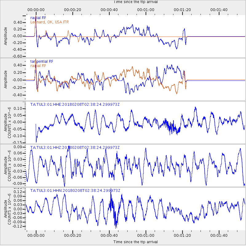
TUL3 Leonard, OK, USA - Earthquake Result Viewer
*The percent match for this event was below the threshold and hence no stack was calculated.
| Earthquake location: |
Greenland Sea |
| Earthquake latitude/longitude: |
79.8/2.0 |
| Earthquake time(UTC): |
2018/02/08 (039) 02:29:14 GMT |
| Earthquake Depth: |
10 km |
| Earthquake Magnitude: |
5.6 Mww |
| Earthquake Catalog/Contributor: |
NEIC PDE/us |
|
| Network: |
TA USArray Transportable Network (new EarthScope stations) |
| Station: |
TUL3 Leonard, OK, USA |
| Lat/Lon: |
35.91 N/95.79 W |
| Elevation: |
265 m |
|
| Distance: |
56.3 deg |
| Az: |
284.816 deg |
| Baz: |
12.246 deg |
| Ray Param: |
$rayparam |
*The percent match for this event was below the threshold and hence was not used in the summary stack. |
|
| Radial Match: |
47.851818 % |
| Radial Bump: |
400 |
| Transverse Match: |
56.497936 % |
| Transverse Bump: |
400 |
| SOD ConfigId: |
2546091 |
| Insert Time: |
2018-02-22 02:34:52.498 +0000 |
| GWidth: |
2.5 |
| Max Bumps: |
400 |
| Tol: |
0.001 |
|
Signal To Noise
| Channel | StoN | STA | LTA |
| TA:TUL3:01:HHZ:20180208T02:38:24.299973Z | 1.6263791 | 4.6016996E-8 | 2.8294139E-8 |
| TA:TUL3:01:HHN:20180208T02:38:24.299973Z | 1.2704941 | 5.9150192E-8 | 4.655684E-8 |
| TA:TUL3:01:HHE:20180208T02:38:24.299973Z | 1.2644747 | 5.3368236E-8 | 4.2205855E-8 |
| Arrivals |
| Ps | |
| PpPs | |
| PsPs/PpSs | |


