You are here: Home > Network List > US - United States National Seismic Network Stations List
> Station AMTX Amarillo, Texas, USA > Earthquake Result Viewer
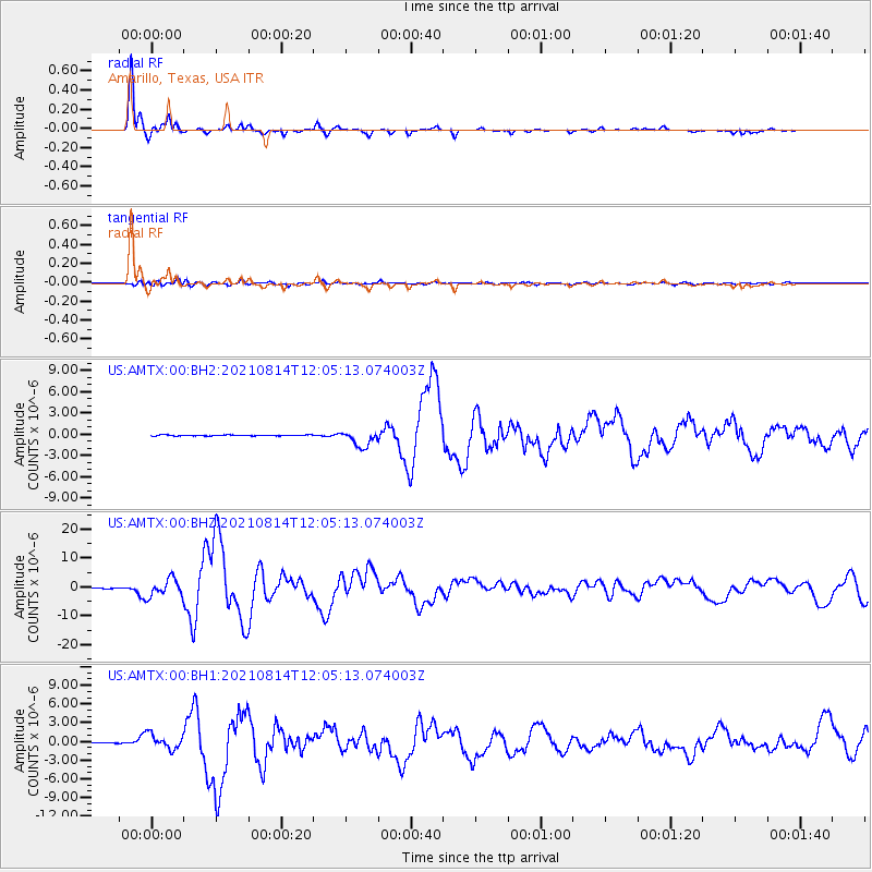
AMTX Amarillo, Texas, USA - Earthquake Result Viewer
*The percent match for this event was below the threshold and hence no stack was calculated.
| Earthquake location: |
Alaska Peninsula |
| Earthquake latitude/longitude: |
55.2/-157.7 |
| Earthquake time(UTC): |
2021/08/14 (226) 11:57:42 GMT |
| Earthquake Depth: |
4.8 km |
| Earthquake Magnitude: |
6.4 ml |
| Earthquake Catalog/Contributor: |
NEIC PDE/ak |
|
| Network: |
US United States National Seismic Network |
| Station: |
AMTX Amarillo, Texas, USA |
| Lat/Lon: |
34.53 N/101.41 W |
| Elevation: |
1010 m |
|
| Distance: |
43.5 deg |
| Az: |
94.356 deg |
| Baz: |
316.23 deg |
| Ray Param: |
$rayparam |
*The percent match for this event was below the threshold and hence was not used in the summary stack. |
|
| Radial Match: |
98.40745 % |
| Radial Bump: |
263 |
| Transverse Match: |
87.80601 % |
| Transverse Bump: |
400 |
| SOD ConfigId: |
25131211 |
| Insert Time: |
2021-08-28 12:23:20.333 +0000 |
| GWidth: |
2.5 |
| Max Bumps: |
400 |
| Tol: |
0.001 |
|
Signal To Noise
| Channel | StoN | STA | LTA |
| US:AMTX:00:BHZ:20210814T12:05:13.074003Z | 25.917376 | 3.0386784E-6 | 1.1724484E-7 |
| US:AMTX:00:BH1:20210814T12:05:13.074003Z | 10.703278 | 1.187846E-6 | 1.1097965E-7 |
| US:AMTX:00:BH2:20210814T12:05:13.074003Z | 21.678474 | 1.2279547E-6 | 5.6643966E-8 |
| Arrivals |
| Ps | |
| PpPs | |
| PsPs/PpSs | |


