UTMT Martin, TN - Earthquake Result Viewer
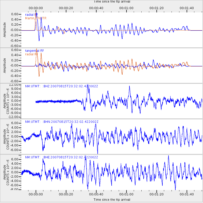
Earthquake location: Andreanof Islands, Aleutian Is.
Earthquake latitude/longitude: 50.3/-177.5
Earthquake time(UTC): 2007/08/15 (227) 20:22:11 GMT
Earthquake Depth: 9.0 km
Earthquake Magnitude: 6.3 MB, 6.2 MS, 6.4 MW, 5.9 ML
Earthquake Catalog/Contributor: WHDF/NEIC
Network: NM Cooperative New Madrid Seismic Network
Station: UTMT Martin, TN
Lat/Lon: 36.34 N/88.86 W
Elevation: 120 m
Distance: 62.3 deg
Az: 65.728 deg
Baz: 313.635 deg
Ray Param: 0.06031591
Estimated Moho Depth: 10.0 km
Estimated Crust Vp/Vs: 1.66
Assumed Crust Vp: 6.444 km/s
Estimated Crust Vs: 3.888 km/s
Estimated Crust Poisson's Ratio: 0.21
Radial Match: 91.9465 %
Radial Bump: 400
Transverse Match: 85.52103 %
Transverse Bump: 400
SOD ConfigId: 2564
Insert Time: 2010-03-09 11:42:03.471 +0000
GWidth: 2.5
Max Bumps: 400
Tol: 0.001

Signal To Noise

ChannelStoNSTALTA
NM:UTMT: :BHN:20070815T20:32:02.422002Z1.64113911.8152817E-61.1061107E-6
NM:UTMT: :BHE:20070815T20:32:02.422002Z2.3676592.0180878E-68.523557E-7
NM:UTMT: :BHZ:20070815T20:32:02.422002Z9.8214674.7737994E-64.860577E-7
Arrivals
Ps1.1 SECOND
PpPs3.9 SECOND
PsPs/PpSs5.0 SECOND