
UTMT Martin, TN - Earthquake Result Viewer
| ||||||||||||||||||
| ||||||||||||||||||
| ||||||||||||||||||
|
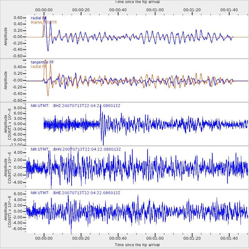
Signal To Noise
| Channel | StoN | STA | LTA |
| NM:UTMT: :BHN:20070713T22:04:22.086013Z | 1.7783461 | 1.7151598E-6 | 9.644691E-7 |
| NM:UTMT: :BHE:20070713T22:04:22.086013Z | 1.4614507 | 1.7253603E-6 | 1.1805806E-6 |
| NM:UTMT: :BHZ:20070713T22:04:22.086013Z | 2.7117307 | 4.7658386E-6 | 1.7574896E-6 |
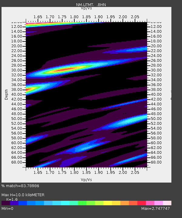
| Arrivals | |
| Ps | 1.0 SECOND |
| PpPs | 3.8 SECOND |
| PsPs/PpSs | 4.8 SECOND |

