
UTMT Martin, TN - Earthquake Result Viewer
| ||||||||||||||||||
| ||||||||||||||||||
| ||||||||||||||||||
|
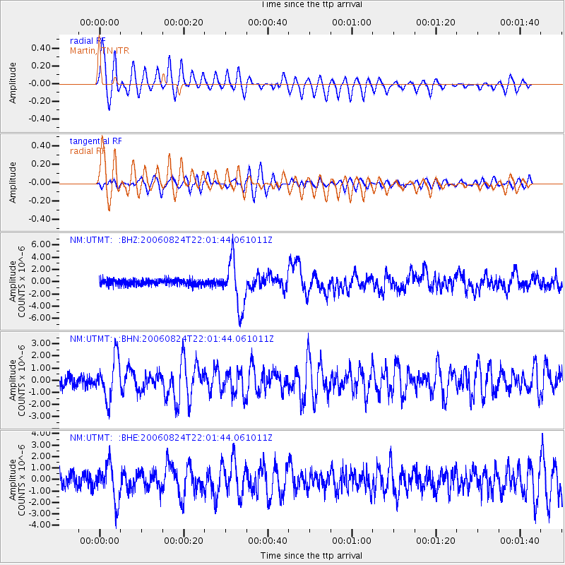
Signal To Noise
| Channel | StoN | STA | LTA |
| NM:UTMT: :BHN:20060824T22:01:44.061011Z | 3.9242713 | 1.7374103E-6 | 4.4273452E-7 |
| NM:UTMT: :BHE:20060824T22:01:44.061011Z | 2.9982023 | 1.606697E-6 | 5.358868E-7 |
| NM:UTMT: :BHZ:20060824T22:01:44.061011Z | 8.467544 | 3.980071E-6 | 4.7003843E-7 |
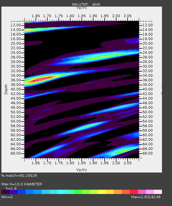
| Arrivals | |
| Ps | 1.0 SECOND |
| PpPs | 3.9 SECOND |
| PsPs/PpSs | 4.9 SECOND |

